EagleView’s Post-Event Imagery Reveals Damage Following Hurricane Florence
Pre- and post-event imagery, augmented by machine learning technology, yields important information regarding hurricane’s impact
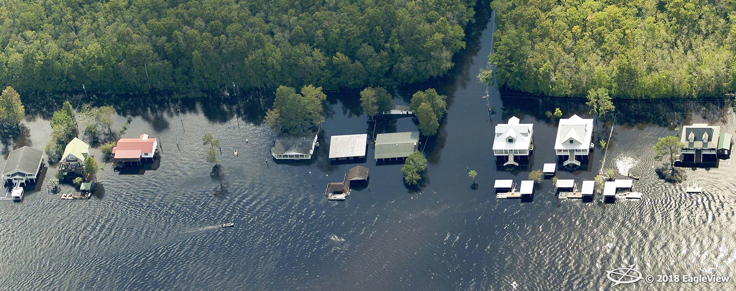
Bothell, WA (September 20, 2018)– Eagle View Technologies (“EagleView®”), the leading provider of aerial imagery and property data analytics for the government, insurance and commercial sectors, has captured and processed ultra-high-resolution imagery of areas affected by Hurricane Florence. Following admission into the airspace by the Federal Aviation Administration (FAA) on Monday, September 17, EagleView took flight to capture areas along the East Coast.
With an image library of more than 400 million images, EagleView’s pre- and post-event aerial imagery offers critical information to government agencies, insurance carriers and electric utilities looking to analyze the damage following the storm. Customer can access both pre- and post-event imagery on EagleView’s image platform, CONNECTExplorer™.
“This is the type of data our customers need to fully comprehend the extent of the damage following a storm,” stated EagleView CEO Rishi Daga. “By activating all of our image capture sources—drone, fixed-wing and satellite—we can provide that imperative data, as well as the before and after imagery to our customers, which will ultimately assist in getting homeowners back into their houses faster.”
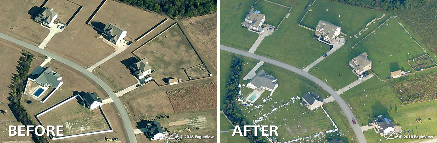
Through the application of machine learning to the post-event imagery, EagleView can also offer its customers in-depth answers around the level of damage found at each property. By stratifying potential property damage within each image based on probability thresholds, insurance carriers can classify damage efficiently, resulting in a rapid closing of claims. This high-speed process allows carriers to analyze images quicker than ever before.
“Our ultra-high-resolution imagery is incredible, but it’s what comes after the image capture that truly makes us unique,” stated EagleView COO Jay Martin. “The application of machine learning and our ability to offer pre- and post-event imagery to identify property damage is the true solution to our customers’ needs. It’s technology like this that’s going to change the way the world responds to natural disasters.”
EagleView continues to fly and capture high-resolution aerial imagery following Hurricane Florence. Post-event imagery is now available via RapidAccess™, and will continue to be added as it is flown and processed.
For more information around EagleView’s disaster response following Hurricane Florence, please contact Melissa Mazurek at melissa.mazurek@eagleview.comor (585) 444-2504.


About EagleView
EagleView is the leading provider of high-resolution aerial imagery, property data analytics and structural measurements for government agencies, insurance carriers, roofing contractors and energy utilities. Using patented image capture techniques, 3D aerial measurement software and machine learning processes, EagleView helps customers answer questions related to millions of properties throughout the world. With a 60-petabyte library of oblique and orthogonal Pictometry® aerial imagery dating back to 2001 and the capacity to process tens of thousands of roof measurement reports per day, EagleView enables organizations to reduce field visits and adopt faster, safer and more cost-effective workflows. For more information, contact (866) 659-8439 or visit www.eagleview.com.
###