Located southeast of the City of Baton Rouge, Ascension Parish is divided by the Mississippi River. Founded in 1845, the parish currently occupies a land area of 292 square miles with over 50,000 parcels and serves an estimated population of 117,029. M. J. “Mert” Smiley, Jr., Ascension Parish Assessor, has watched the parish grow 9.2% since the U.S. Census of 2010. Elected to office in January 2013, he had a strong desire to apply the concept of “Good to Great” to the
assessment office by becoming the most modern and efficient Assessor’s Office in the State of Louisiana.
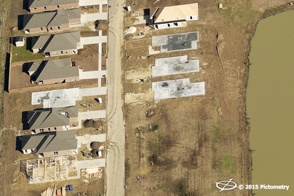
A new development in Ascension Parish.
Since 2011, the petrochemical industry has announced $6 billion in capital investments for new and expanding businesses in Ascension Parish. With local businesses benefiting from a close proximity to a transportation network of deep-water ports on the Mississippi River, Class I railroads, interstate highways, interstate pipelines, and international airline service in Baton Rouge and New Orleans, Smiley knew that this growth rate would most likely continue. The industry growth continues creating job opportunities as well as spurring new housing construction and stimulating the local real estate market. Smiley knew he needed to be in step with this growth for the good of the community.
Going from "Good" to "Great"
In order for the Ascension Parish assessment office to become great, Smiley recognized the need to make significant improvements to their information technology. He began by scanning all of their files and creating internal electronic accessibility, along with generating a user-friendly online map and online application forms; all free to the public reflecting accurate information for each parcel in the parish. “To help accomplish this goal, we knew we needed to use the latest mass appraisal and statistical software, aerial imagery, and sketching software to develop valuation models,” stated Smiley. “We wanted it based upon recent sales and square footage and by using valuation models we were able to eliminate any bias. Fairness in property taxation cannot be assured if assessments are not based upon what the property is worth.”
“Our aerial imagery and technology project was implemented in 2014 after several field deputies discovered in 2013 that numerous parcels across our parish were missing improvements,” continued Smiley. “We quickly realized it would take five to eight years to completely review all parcels. Plus, we encountered a lack of sufficient access on large tracts where improvements were hidden far off the road. The main reason we even started to review parcel information was because we were aware that a majority of properties had not been reassessed for over two and sometimes three decades, despite Louisiana law requiring reassessment every four years.”
Implementing Imagery as a Solution
“We began weighing our options to address these issues,” stated Justin Champlin, Chief Deputy Assessor for the Ascension Parish Assessor. “Our first option was sticking with our current “boots on the ground” method, but the limitations made that option truly unfeasible. Our second option was the use of high-resolution aerial imagery combined with sketching software. Despite searching for a third option, we quickly recognized our second option was the most viable, but we needed to ensure its success by fitting it into our computer assisted mass appraisal (CAMA) system.”
In order to ensure the solution was a good fit, the team contacted their CAMA vendor, Software & Services, to get input on aerial imagery and sketching software vendors. They learned there was an existing relationship with a sketching software vendor, APEX. Most importantly, sketches from APEX could be
integrated into the CAMA system. At this point, they knew the solution could work, but it needed the aerial imagery component. It was not long before they learned that Pictometry was able to provide oblique and orthogonal high-resolution aerial imagery, which APEX could use to sketch improvements and carve out the non-living areas from the living areas. It was a winning solution, however it would require funding.
Sharing the Project Costs
Many great ideas never get off the ground because of the lack of funding. “Without question, we were fortunate to obtain funding from two sources,” Champlin said. “The first source of funding came from all the taxing districts in Ascension Parish that receive property tax revenue. Each taxing district’s portion of funds was calculated based upon each taxing district’s percentage of the total millage. By using previous information discovered from our “boots on the ground” method, we projected the potential increase in revenue in comparison to taxing districts’ portion of the project cost in order to gain approval. Within two months, we had secured approval of all taxing districts, who subsequently signed an intergovernmental agreement to fund the project. Our second source of funding unexpectedly came two months after the intergovernmental agreement was signed. We were awarded a $150,000 federal grant from the Delta Regional Authority. With sufficient funding in place, our project was now able to literally get off the ground.”
In February 2014, three-inch,
high-resolution aerial imagery was captured by Pictometry. The assessment team deployed Pictometry’s web-based imagery delivery software, PictometryOnline™ (POL), which has since been replaced by
CONNECTExplorer™. Training was then provided to assessment office personnel along with several other taxing body employees. Once the imagery was available in POL, APEX began sketching every single improvement in the parish. Within a five month time period, APEX had sketched 40,000 parcels that had seen improvements. They were then able to pull the APEX sketches into the CAMA system so employees could apply valuation purposes to each respective parcel. Because the project focused on locating the missing improvements, they were able to identify them and mark them as unidentified improvements. Those parcels then were not integrated into the system unless an improvement property item was created for the corresponding parcels.
Millions of Dollars in Tax Revenue Realized
“Once we finished adding the unidentified missing improvements to the respective parcels, our numbers indicated 15% of the parcels were missing improvements that should have been on the roll,” Smiley said. “In addition, we removed over 3,000 multiple homestead exemptions. At the end of the day, we exceeded our tax revenue increase projections as we experienced an $18.1 million increase in tax revenue. Of the overall tax revenue increase, schools received over $10.3 million, parish government received over $2.9 million, law enforcement received over $2.4 million and libraries received over $1.1 million.”
In addition to the tax revenue increase, Ascension Parish was able to modernize the assessment office by creating a new user-friendly online map free to the public, offering an online homestead exemption form, using new technology to appraise property and implementing several other technology upgrades.