Bordering Utah in Southwestern Colorado, Montrose County has a population of 41,000 people and covers 2,200 sq. miles. The county itself is about the size of the entire state of Delaware. The land is a diverse mixture of agriculture, forest, desert and canyons. Due to the size and the topography, Brad Hughes, MAI, Montrose County Assessor, was aware of the obstacles facing the county appraisers for assessments. He turned to imagery from Pictometry
®, now known as EagleView
®, for support.
In Montrose County, there are 25,000 real property accounts with 30 percent of the land being privately owned and 70 percent public. Managing this land in the Assessor’s office falls on one assessor, four appraisers and four administrative staff members. Hughes knew he needed additional resources and understood the value that EagleView aerial
orthogonal and
oblique imagery would provide.
The county was flown entirely throughout 2013 and into 2014 using both three-inch neighborhood resolution in the more populated areas and nine-inch community resolution in the more desolate areas that comprise a majority of the county. Montrose began using the imagery in 2014 and the entire office team accesses the imagery and platform of analytical tools through
CONNECTExplorer™, a cloud-based platform with access for multiple users.
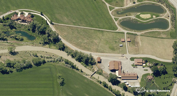
Omitted structures are common throughout the agricultural lands in Montrose due to the fact that building permits are not required for agricultural outbuildings. Since beginning to use EagleView, the county has discovered over 516 omitted structures and sub areas and has added an additional $6,655,000 in omitted actual value with approximately $70,500 in property taxes per year. This included the discovery of a $2,250,000 transmission line that was incorrectly apportioned to an adjacent county. Using the latitude and longitude coordinates from the imagery confirmed the true placement of the transmission towers that ran along the border between the two counties.
When field visits are necessary, Montrose appraisers utilize EagleView’s
Electronic Field Study (EFS) software using tablet PCs. With poor cellular connectivity in the county, it was difficult to login to web-based POL accounts, so they turned to using HP Pro X2 Tablet PC’s to view their EagleView imagery. “We loaded up all 2,200 sq. miles of the county’s orthogonal EagleView imagery onto the tablets,” Hughes commented. “It’s so convenient to have it all there at our fingertips even without being connected to the internet.”
With the EFS software, appraisers are capable of searching basic ownership and parcel information by name, address, parcel number or even account number.
“This tool is extremely useful for road navigation in unmarked and remote areas. Plus, it assists us in viewing large agricultural tracts, mountainous properties, and structures behind locked gates,” Hughes stated. This software also allows for appraisers to find the ownership information when new construction is discovered and identify boundary and ownership lines on unimproved properties, especially in holdings on public lands.
Groundwork is being laid for
ChangeFinder™ to be implemented in Montrose County as well. “Ultimately, we want to establish a clean layer of sketch and building data to compare against future EagleView aerial imagery,” concluded Hughes. “We’re looking to ChangeFinder to establish this layer and discover these property changes.”