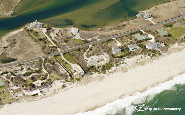
Located on the South Fork of Long Island, the Town of Southampton is known for beautiful beaches, spectacular homes and thriving tourism. For town assessor Lisa Goree, it also means many properties that are gated or only occupied during the summer months. Visual inspection is important for any
assessment office, and Goree found a means to obtain fair and equitable assessments using technology.
Southampton began using Pictometry® aerial imagery technology for tax assessing beginning with their 2009 assessment roll. Pictometry (prior to becoming EagleView) invented the ability to capture oblique imagery--aerial imagery captured at a forty-five degree angle. Suffolk County, where Southampton is one of 10 towns, received
Pictometry imagery of the entire county in 2006. Southampton found it so beneficial that the town paid to have it flown again in 2008, 2011, and 2014. The Assessor’s Office took it one step further with the 2008 flyover and added an important new product called
ChangeFinder™. This new product produced a change comparison file that could compare image data from 2001 to 2007.
ChangeFinder delivers data on properties that have seen change year-over-year, saving time and money for assessment offices. “We wanted to find properties that had physical changes through 2008,” stated Goree. “We did; in fact, we found $13 million in assessment changes that was added to our 2009 assessment roll. We are a believer. ChangeFinder was also a part of our subsequent flyovers."
Goree worked with Ross Baldwin, GIS Manager, to track changes by neighborhood using ChangeFinder. Reports in the township are done by hamlets, but within the hamlets there are different neighborhoods. Goree and Baldwin worked on getting the results from ChangeFinder for each neighborhood to accurately calculate the ROI.
“I have worked with Pictometry since day one,” stated Baldwin. “Initially we had Electronic Field Study (EFS), the original desktop solution, but it wasn’t long before we switched to self-hosting and then to
CONNECTExplorer™, Pictometry’s cloud-based visualization and analytical platform. The efficiencies we have gained from this software have been monumental.”
“Now we can sit at our computer, look at the property and use the measurement tools to do assessments,” Goree continued. “We love the measurement tools and continually gain data and information about the parcels. ChangeFinder is amazing. We had a community/village that was only 50 percent developed, but we were able to find 10 percent change in the area due to ChangeFinder, and it was key to our overall assessment.”
With 50,000+ parcels and many diverse areas in the Town of Southampton, Goree has found technology advances to be the key to her success. “When the International Association of Assessing Officers (IAAO) approved aerial imagery for Mass Appraisal of Real Property (MARP), we were very happy. We can use Pictometry technology within MARP, and since we assess at 100 percent market value every year, it makes a huge difference. Every property must be inspected or viewed from the public right-of-way at least once every six years according to NYS Office of Real Property Service (ORPTS), but we are required to have the aerial imagery updated every three years to comply with IAAO.”
Goree has 11 in-office staff, including three field staff. The whole team uses Pictometry imagery to not only verify and look at properties but also to identify farm and vacant land. With 700 agricultural properties in Southampton, that is an important time-saver. “We need to verify if it is actually being used for agriculture or if it is fallow,” confirmed Goree. “We also use CONNECTExplorer for conferences with attorneys for tax settlements and permitting.”
In fact, the Southampton assessment office used to have a much larger staff since they would need to go through old permits to figure out which properties to inspect in the field. It would take a tremendous amount of time to collect the data. Today, they may still reference permits, but by utilizing ChangeFinder before-and-after imagery, they can see what has been changed, remodeled, or demolished. Goree’s team now spends their time comparing and cross-referencing permits against ChangeFinder and have saved an immense amount time and energy.
“It has also helps other agencies in the township,” stated Baldwin. “Code enforcement, law enforcement, and various fire departments all use it as well. The assessment office foots the bill for the imagery, but it is not just the assessment office that uses it. Many other departments see large benefits. We have been able to use technology to bring the right change to Southampton. It has benefited the entire town and everyone who lives or visits here.”