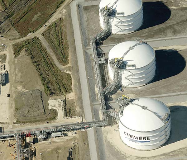
Cheniere Energy, Inc. is a dynamic, integrated energy company based in Houston, Texas. They operate the world’s largest receiving terminal for Liquid Natural Gas at the mouth of the Sabine River in Louisiana and the 94-mile-long Creole Trail pipeline, which was commissioned in 2008.
During the construction project, the company developed a comprehensive, state-of-the-art digital GIS database covering the entire corridor. In addition, orthogonal, or top-down, aerial imagery was used to validate field data. Cheniere Energy was determined to set a benchmark for the pipeline’s integrity management program.

Ever conscious of the need to leverage new technology, Cheniere Energy found a way to improve the quality of their data and processes in the fall of 2010 by utilizing
EagleView imagery (formerly Pictometry) and CONNECTExplorer™ (formerly Pictometry Online). Now this forward-thinking company is using visual intelligence from EagleView to identify structures, classify locations and dramatically reduce the number of areas that need on-site ground verification. Prior to implementing EagleView solutions, the company went to great lengths to establish a benchmark dataset for pipeline integrity management.
To ensure the quality and integrity of its new Creole Trail pipeline Cheniere Energy set uncompromising standards for pipe milling and manufacturing with each joint bar-coded to facilitate location and maintenance. Surveyors captured the exact GPS coordinates for 70 percent of the welds on the pipeline, providing the foundation for a precise Geospatial digital database.
The company enriched its GIS data to include layers of information on structures, roads, railroads, utility crossings, encroachments and more. Sophisticated tools were implemented to make real-time updates to the database whenever changes to High Consequence Area (HCA) borders and class locations were detected. Lastly, orthogonal, or top-down, aerial imagery of the entire Creole Trail corridor was updated.
“The orthogonal imagery basically gave us a picture of what’s on the ground,” explained Chris Williams, the Director of Pipeline Technical Services. “So it provided up-to-date visual verification of the field information in our database.”
It was all part of an ambitious effort to build a strong foundation for pipeline integrity management. “Our goal right from the beginning was to build a state-of-the-art dataset to manage our pipeline, maintain safety and evaluate threats and risks,” Williams said.
After the pipeline went into operation, Williams learned about EagleView's innovative approach to aerial imaging: capturing high-resolution aerial images at an oblique angle to reveal important dimensional information and details that are lost in traditional orthogonal imagery.
The EagleView images would allow Cheniere’s integrity management team to see every square foot of the pipeline’s Potential Impact Radius from overhead and oblique angles, identify hard-to-see structures, perform precise measurements, and quickly determine latitude, longitude, directional bearing and relative positioning. The team would also be able to use POL to add annotations, access information and overlay aerial images with maps, parcel boundaries, elevation contours and other digital information.
“We wanted to see what EagleView could do for us,” Chris recalled. “And we wanted to see the images they already had in their database on our corridor. It simply made sense from a due diligence standpoint.”
A few days before the presentation Williams had been on a routine patrol with company technicians driving along the Creole Trail corridor when he noticed a building that seemed out of character with the rest of the area.
From a quick, drive-by view, it looked like it might be a family residence. But he was pretty sure that there wasn’t a residence shown in that particular area in the company’s database. On the day of the EagleView demonstration, Williams asked to navigate to the address in question, explaining to everyone in the room the reason for the request: there might be an error in the database that could affect the structure count along that segment of pipeline.
POL quickly located the right address and after zooming in, the image on the screen clearly showed two electrical service boxes on a wall and a trampoline behind the structure; features that could not be identified using the company’s existing orthogonal imagery.
“Right away we could see it was a residential building,” Williams recalled. “And that meant we needed to ground truth the structure and update our database. It really proved the point that EagleView images would help validate our data and improve our integrity management program.”
Cheniere is now using POL as a mainstay tool in its Pipeline Integrity Management Program and found that EagleView dramatically reduced the amount of ground verification required to maintain comprehensive and accurate population density data. “If you can make the call from looking at an oblique aerial image, you don’t need to send out a field crew,” Williams explained.
“Basically, EagleView helps us evaluate risks and consequences along our pipeline so we can perform preventive and mitigative actions,” Williams said, “which helps us optimize the way we use our resources to protect the pipeline. That’s a pretty solid business case for a very reasonable investment.”
Cheniere Energy’s most recent project consists of a 13.7 mile expansion of the Creole Trail Pipeline to be constructed in Cameron, LA. EagleView was secured to capture high-resolution aerial imagery of the right-of-way for the expansion. This will allow Cheniere Energy’s team to use the images for production of pipeline alignment drawings. EagleView also recently flew approximately 40 miles of existing pipeline right-of-way. These updated images will be beneficial in monitoring changes in landscape of possible encroachment issues.
“EagleView Online has increased our confidence in the accuracy of our data and helped us improve operational efficiency and integrity management,” Williams said. “When you consider all of the benefits, it’s clear that we’re getting a lot of value from the solution.”