Alvin Lankford is a man who likes to talk about ROI. And it’s no wonder.
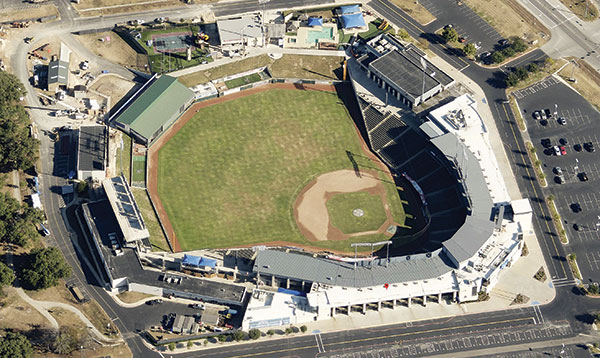
As Chief Appraiser for the Williamson Central Appraisal District (WCAD) in Williamson County, Texas, Lankford has been instrumental in the implementation of EagleView aerial imagery and companion software to accurately
assess property values and taxes in the 187,000-parcel county since 2009. He’s been an enjoying a huge ROI on his investment ever since.
“I couldn’t be happier with what we’ve achieved,” says Lankford. “And I know our Board of Directors is thrilled, too.”
The reasons for their pleasure are clear. Since implementing Pictometry technology from EagleView Technologies, a leading-edge technology company specializing in high-resolution aerial image capture, 3D measurement technologies and overall software solutions, Williamson County has benefited from a tremendous return on their investment.
“The Gift That Keeps on Giving”
While Lankford is pleased with the initial ROI that Pictometry imagery has generated, he’s even more pleased with the fact that benefits of its use will be realized for years to come.
“The great thing about adding value to the roll and receiving increased tax dollars is that the tax income isn’t just a one-time thing,” says Lankford. “The $464,000 tax increase we saw in 2012 is $464,000 that we’ll see this year and next year and the year after that. I like to call it the gift that keeps on giving.”
No More Guesswork and Locked Gates
Prior to the introduction of
EagleView imagery (formerly Pictometry), Lankford and his appraisal team spent a great deal of time on the road attempting to appraise properties. Despite their best efforts, circumstances such as locked gates or fences prevented them from appreciating the full scope of some properties and they were often left making best guesses.
But as Lankford relates, “Pictometry [imagery] solves that problem and more.”
For example, in 2012 the team uncovered 350 unaccounted swimming pools that led to an additional $200,000+ in taxes. In addition, using
sketch verification allowed them to overlay current images over past sketches to reveal unreported additions and modifications to the tune of $2.2 million.
EagleView imagery has enabled WCAD to make valuation adjustments based on:
- the installation of sewer and water
- agricultural valuation
- extended power lines
- development
“These are the kind of changes that we might have missed in the past. But with Pictometry, we can view them from our desks and make adjustments accordingly,” says Lankford. He also notes that not all adjustments are to the detriment of the landowner.
“We’ve had instances where a land owner comes in to protest their valuation. With Pictometry [imagery], I can call up an image of their property right there with them at my side. We can look at the topography and elevations. If I can see that a good chunk of their property is, say, cliff face, we can adjust the valuation down accordingly.”
Keeping Tabs on Commercial Development
In addition to private property, EagleView has applications for commercial and business property.
“Pictometry offers a pretty painless way to assess commercial property and inventory,” explains Lankford. “Take an auto dealership. With the aerial images we can accurately get a count of the vehicles on the lot that day. Or, in the case of multiple unit strip centers, we use the imaging to measure individual units and assess them appropriately. It’s just a matter of calling up the image on our desktop, and adjusting the measurements. Everything’s accurate, everyone’s happy.”
Benefits Beyond the Tax Rolls
Like other counties across the country, Williamson has begun to use EagleView imagery to do more than adjust the property taxes and assessments.
Currently the Williamson
police department is using the WCAD provided imagery to analyze crime scenes. The fire department actively uses the same images in the pre-planning for fighting fires on different structures, especially those prone to fires. As Lankford notes, this type of planning could help minimize the damage and loss of life that might be incurred should a fire breakout at an industrial complex.
“The images will allow them to quickly assess all the ways in and out for the public as well as firefighters. This is especially true and important at night when Pictometry images basically turn night into day,” says Lankford.
“The police department is also exploring how to use imaging to assist with the handling of active shooter situations when, again, knowing the ways in and out are a matter of life and death.” He adds, “An aerial image is also important when trying to determine where you need to evacuate in bomb situations. The image offers an instant circumference to clear, no questions asked.”
Lankford notes that WCAD incurs the entire cost for EagleView and
shares the images with other departments.
“Making the images available to any department that has a use for them simply makes the most sense,” says Lankford. “There’s no need to re-create the wheel for efforts with similar needs and it’s helpful have everyone working from the same data and images. The entire operation runs more smoothly and efficiently.”
Here's a look at the ROI:
- Use of sketch verification with EagleView images: gained $2.2 million in taxes, ROI 116%
- Use of ChangeFinder™ in 2011: added $18.1 million in value, ROI 349%
- Use of ChangeFinder in 2012: added $17.8 million in value, ROI 384%
- Use of PoolFinder in 2012: added $8.1 million in value, ROI 1180%
- Use of ChangeFinder in 2013: added $11,005,000 in value, ROI 391%