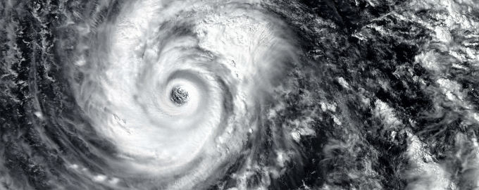
October 15, 2024
In response to Hurricane Milton, EagleView quickly mobilized its fleet to begin capturing detailed orthogonal (top-down, 90-degree angle) and oblique (side view, 40-50-degree angled) aerial imagery as soon as weather conditions allowed.
This imagery can be used by a variety of commercial and government entities to efficiently assess the extent of damage, prioritize recovery efforts, and rebuild essential infrastructure. For existing customers with historical imagery, EagleView’s data applications and change detection solutions can visualize building outlines and show where change has occurred as the result of damages, further streamlining post-disaster assessment and reducing response time.
Sample imagery captured by EagleView reveals the extend of damage in affected areas:
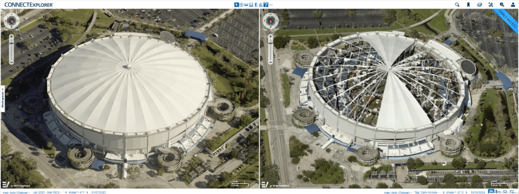

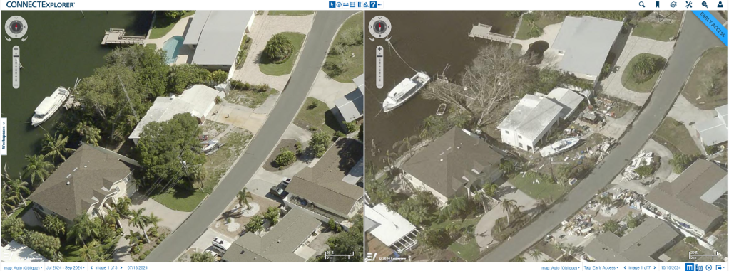
EagleView’s 1-inch (2.54 centimeter) GSD imagery delivers 9 times more pixel data than traditional 3-inch (7.62 centimeter) GSD imagery and up to 70 times more pixel data than commercially available satellite imagery. This industry-leading clarity provides unparalleled accuracy for critical decision making in disaster recovery and beyond. To support its airplane image capture, EagleView is also utilizing multi-modal imaging to help speed the capture and post-event assessment of affected areas
If your organization needs access to Hurricane Milton imagery to support recovery efforts, please contact us.
October 10, 2024
EagleView Capturing the Aftermath of Hurricane Milton
Hurricane Milton made landfall this morning as a Category 3 hurricane along the Gulf Coast of Florida, causing widespread damage. EagleView is actively gathering high-resolution imagery to support emergency response and recovery efforts. Due to the storm’s intensity, we’ve deployed a combination of drone and fixed wing aircraft to ensure fast and accurate coverage.
Our first images, captured via drones, are being processed and will be followed by comprehensive aerial captures once conditions allow. We are committed to delivering critical data to help those on the ground to assess and respond to the damage as quickly as possible.
Stay tuned for further updates as we continue to support recovery operations. For any questions, contact us here.
October 9, 2024
EagleView Prepares for Hurricane Milton's Impact
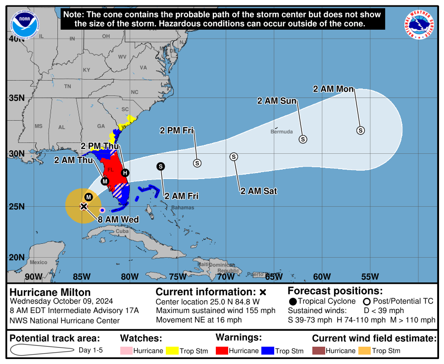
As Hurricane Milton approaches Florida’s Gulf Coast with landfall expected overnight, EagleView has been working around the clock to ensure we are ready to capture vital post-storm imagery as soon as conditions allow.
Our internal teams have been meeting regularly to fine-tune our response strategy, while staying in close contact with local governments in the areas projected to be hit hardest by the storm. This collaboration allows us to prioritize the most critical regions for damage assessment and recovery once the storm passes.
Based on current projections, we will deploy our fleet later this week, weather permitting, to begin capturing 1-inch GSD orthogonal and oblique imagery across the affected areas. These high-resolution images will provide emergency responders and recovery teams with the clear, actionable data they need to assess damage and begin recovery efforts.
As Hurricane Milton is forecasted to make landfall as a Category 4 storm, with potential wind speeds over 150 mph and storm surges up to 15 feet, we understand the urgency of delivering detailed aerial imagery to those on the ground.
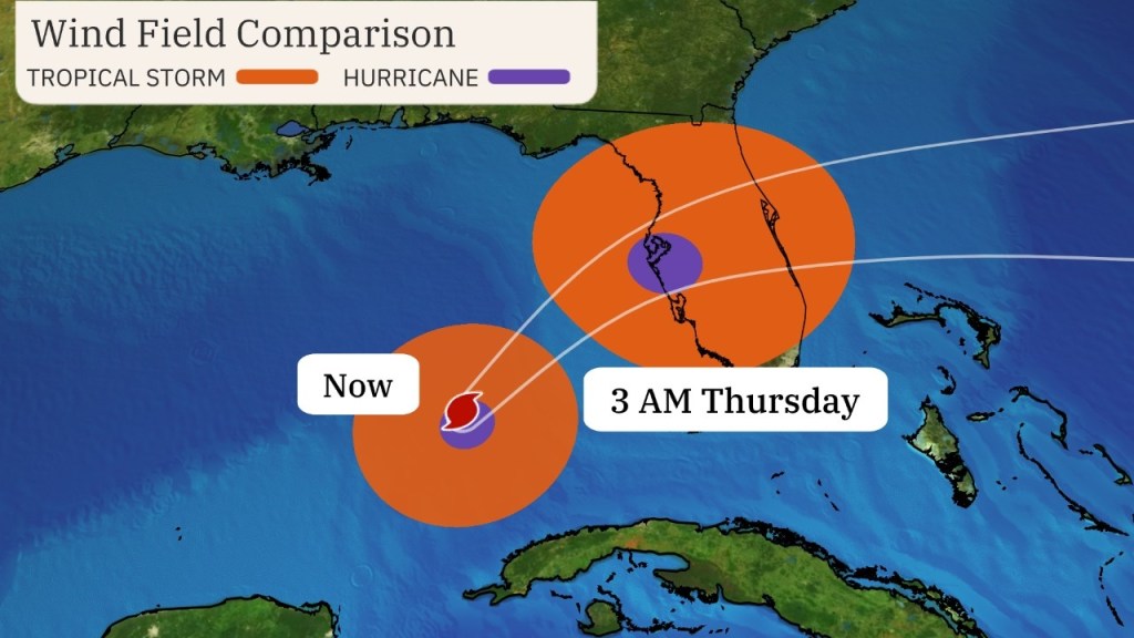
Stay tuned for further updates as we continue to monitor the storm’s progress and adjust our capture plans.
We’ll provide further updates as we proceed. For any questions, contact us here.
October 8, 2024
EagleView is Ready to Respond
As Hurricane Milton quickly approaches the Florida west coast, our team is actively planning and preparing to capture post-storm aerial imagery to aid recovery efforts. The Category 4 storm is expected to make landfall Wednesday night, bringing storm surges of up to 15 feet.
Currently, we’re strategically positioning our aircraft and crews to be ready to capture high-resolution orthogonal and oblique imagery across the impacted areas. Our focus is on delivering the clearest, most detailed aerial imagery to support emergency response, damage assessment, and recovery efforts in multiple cities and regions.
We are closely monitoring the storm's trajectory and weather conditions and will adjust our capture plans as needed. Once the storm has passed and conditions allow, we’ll have our aircraft in the air to begin collecting 1-inch GSD imagery.
We’ll provide further updates as we proceed. For any questions, contact us here.
Request Hurricane Milton Imagery
Contact us to request Hurricane Milton imagery for your disaster response and recovery efforts.