April 13, 2015
 xyHt Magazine featured Pictometry imagery and EagleView solar roof reports in an article about the explosive growth of solar energy in the U.S. and the role played by aerial imagery and surveying.
XYHT: Maximizing the Sun
xyHt Magazine featured Pictometry imagery and EagleView solar roof reports in an article about the explosive growth of solar energy in the U.S. and the role played by aerial imagery and surveying.
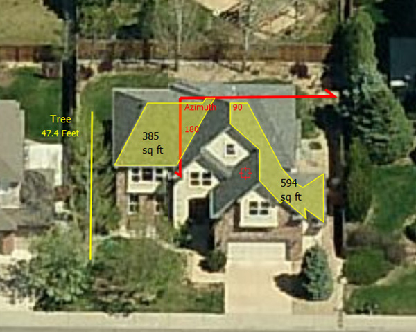
Solar power is booming in the United States. “Every three weeks,” President Obama said in his 2015 State of the Union address, “we bring online as much solar power as we did in all of 2008.” Geospatial technologies—especially remote sensing and surveying—play an important role in siting, designing, and constructing solar arrays, from a few panels on the roof of a house to hundreds of thousands of panels in huge solar farms. The biggest challenge to maximizing the power output of solar panels is … shade! Passing clouds, topographic features, trees, buildings, rooftop installations such as HVAC systems, and even adjacent panels can block the sun’s rays from reaching solar panels. Smart design and construction can mitigate shading, but site selection based on high-resolution aerial imaging and surveying can minimize it up front.Read the article here.