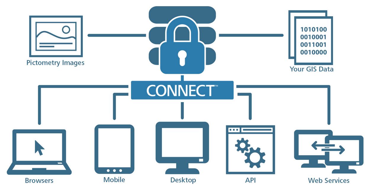
Did you know that our CONNECT™ platform provides imagery access that can be shared across multiple departments?
Here are some ways that departments across your jurisdiction can benefit from access to the high-resolution aerial imagery and analytical tools offered through CONNECT.
ASSESSORS AND APPRAISERS
- Time and gas savings in not having to conduct field inspections, particularly for rural or hard-to-access properties
- Formal and informal appeals
- Preview properties for additions, new construction and permits prior to a field visit
- Investigate land use classifications
- Measure square footage, area, heights, lengths, widths, distances, angles and elevations of buildings, properties and roads
- Achieve ROI and gain new revenues
COMMUNITY PLANNING, ENVIRONMENTAL ASSESSMENT, AND DEVELOPMENT
- Inspect proximity of new developments to housing, schools and roadways
- Measure angles, area, distance, height and width of any structure or property
- View parcels from multiple directions to identify modifications to properties not recognizable from traditional drive-by photos or orthogonal images
- Examine environmentally sensitive areas
LAW ENFORCEMENT
- Identify staging and surveillance areas
- Search, raid and seizure planning
- Preemptive and concurrent tactical planning
- Pictorial references for court presentations and search warrant applications
FIRE DEPARTMENTS
- Pre-plan responses for major structures and facilities
- Zoom in and inspect structural compositions, roof layout and access points
- Access structural inventories such as sprinklers and hazardous material lists
- Send coordinates of house numbering systems to MDTS in vehicles en route
9-1-1
- Quickly view a location using a Lat/Lon coordinate or physical address
- View alternate traffic routes to incidents
- Provide remote guidance on location of electrical wires and other obstacles that might impair equipment or helicopter access; clearly see all that otherwise might not be seen at night
- Monitor foot chases through visual clues and provide assistance to officers on the scene
- Plan for evacuation and traffic control
ENGINEERING, TRANSPORTATION AND UTILITIES
- Import data from GIS and other sources to assess location of water mains, electrical distribution systems, and zoning information
- Calculate acreage or square footage
- Review properties for planning rights of way and easements
- View neighborhoods from growth and traffic flow analysis
Access Pictometry imagery though CONNECTExplorer™ or on your mobile device through CONNECTMobile ™, available through Google Play or the iTunes store.
Want to learn more? Head to our
website.