State and local governments use aerial imagery for a variety of reasons, including project planning, reducing field work, improving efficiency, and keeping people safe. However, governments often need imagery for more than visualization, especially if the imagery needs to be produced to a certain standard or meet accuracy requirements.
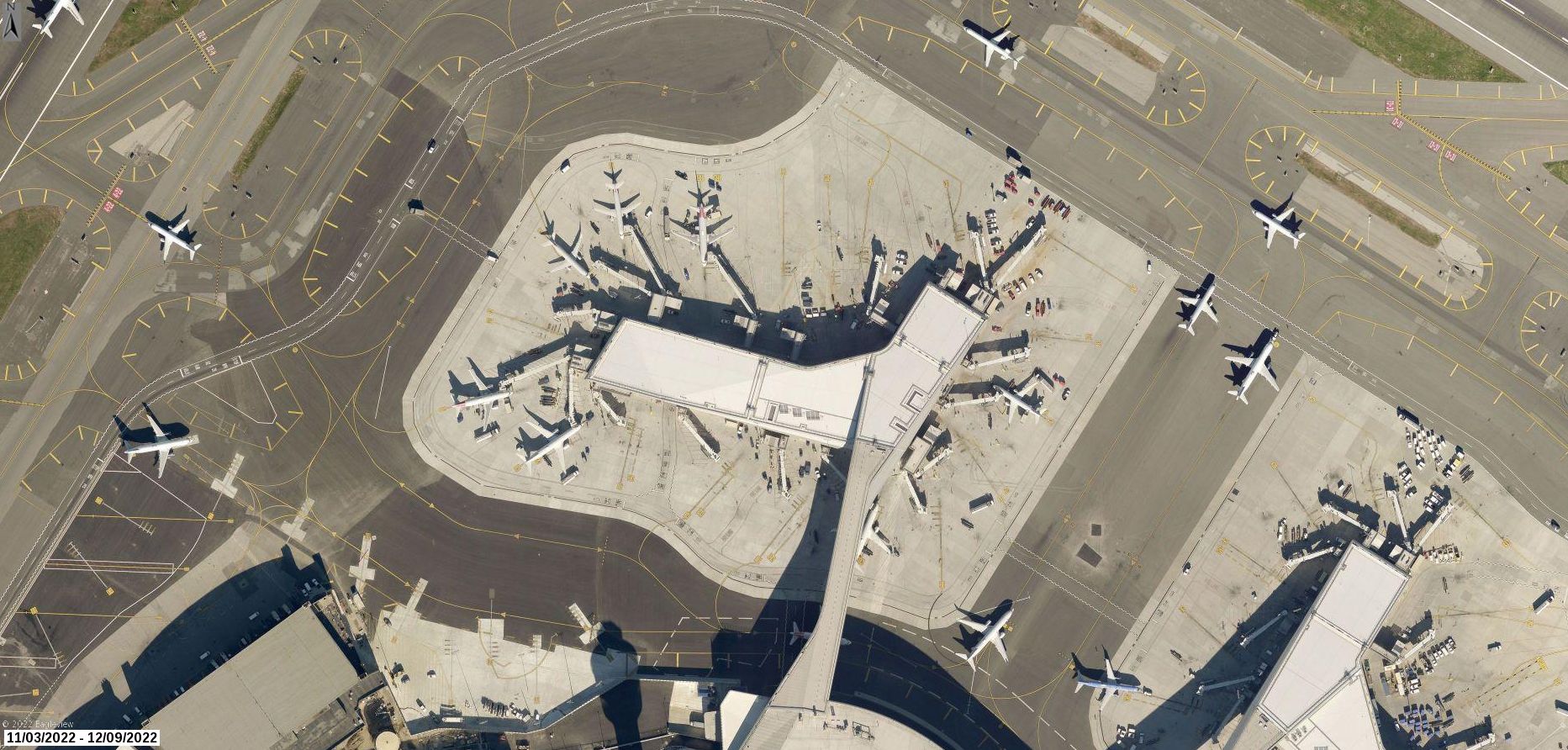
That’s why EagleView offers a Certified Orthomosaic with TrueTouch correction. This upgraded orthomosaic is produced using a full photogrammetric methodology and workflow and includes authoritative statements backed by licensed professionals. The ability to extract high accuracy measurements can then serve as the basis for many GIS applications, 3-D modeling and change detection processes.
What Makes It Certified?
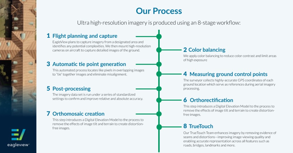
The photogrammetric workflow used to produce EagleView’s Certified Orthomosaic is repeatable and compliant with both the Federal Geographic Data Committee (FGDC) and American Society for Photogrammetry and Remote Sensing (ASPRS) positional accuracy standards. It’s also validated for geospatial accuracy by licensed Photogrammetrists, Engineers, and Surveying professionals, meaning the imagery was produced and tested to performance specifications.
As a result, the imagery is recognized or known to be reliable by experts in the field because it was produced and documented by a methodology that can be replicated and meets a required standard. That means if someone else besides EagleView followed the same process, it would result in the same outcome with imagery at the same level of accuracy.
The Advantages of EagleView’s Certified Orthomosaic Imagery for GIS and Planning Professionals
GIS and planning professionals can use Certified Orthomosaic imagery for authoritative base mapping and asset management, to develop and maintain mapping programs, and to extract highly accurate measurements to build GIS applications, 3-D modeling, and change detection processes.
Greater Confidence in Critical Decisions
Because the imagery is certified to an accuracy standard, GIS and planning professionals experience increased confidence in decision-making and planning power.
Visual Enhancements
EagleView has a dedicated team that manually corrects imagery and applies visual enhancements to critical features, including building lean, inconsistencies, or cut lines where two images do not cleanly line up next to each other.
Upgrade Today
EagleView’s Certified Orthomosaic with TrueTouch correction improves efficiencies and project planning—and reduces field work—for GIS, planning, and engineering teams. Get in touch with us today to learn how it can transform your work.