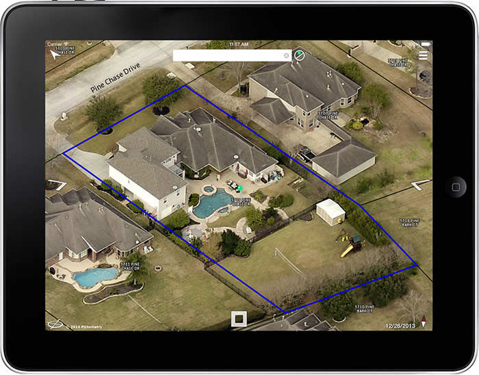
Did you know that you can access Pictometry’s high-resolution aerial imagery from your smartphone or tablet? The CONNECTMobile™ app provides the same features that you are used to using on your computer.
Search an address and be instantly presented with the best image of that location. Zoom in on a specific property or zoom out to assess an entire neighborhood. Measure, inspect, and analyze using the same measurement and analytic tools available on the CONNECT platform. Query GIS data from CONNECT-hosted layers. Pictometry CONNECTMobile is available to all CONNECT customers and eligible PictometryOnline™ customers.
Features:
- Search by address or location
- Easy to navigate, pan, and zoom
- Measure distance, height, area and bearing on any image. Retrieve location and elevation data for any image
- Overlay CONNECT-hosted GIS shape data on imagery
- Query data from CONNECT-hosted GIS layers
- Text search on CONNECT-hosted GIS layers
- Overlay US Parcel and US Street shape data on imagery
- Save or email an image
- Copy measurement and query results to the clipboard.
- Automatically navigate to your current position
- Switch between imagery and map view
- New enhanced search on CONNECT-hosted GIS layers
- New Contour lines are now available as a drawable layer
- New supporting of Point and Bounding Box searches
Download for iOS here.
Download for Android here.