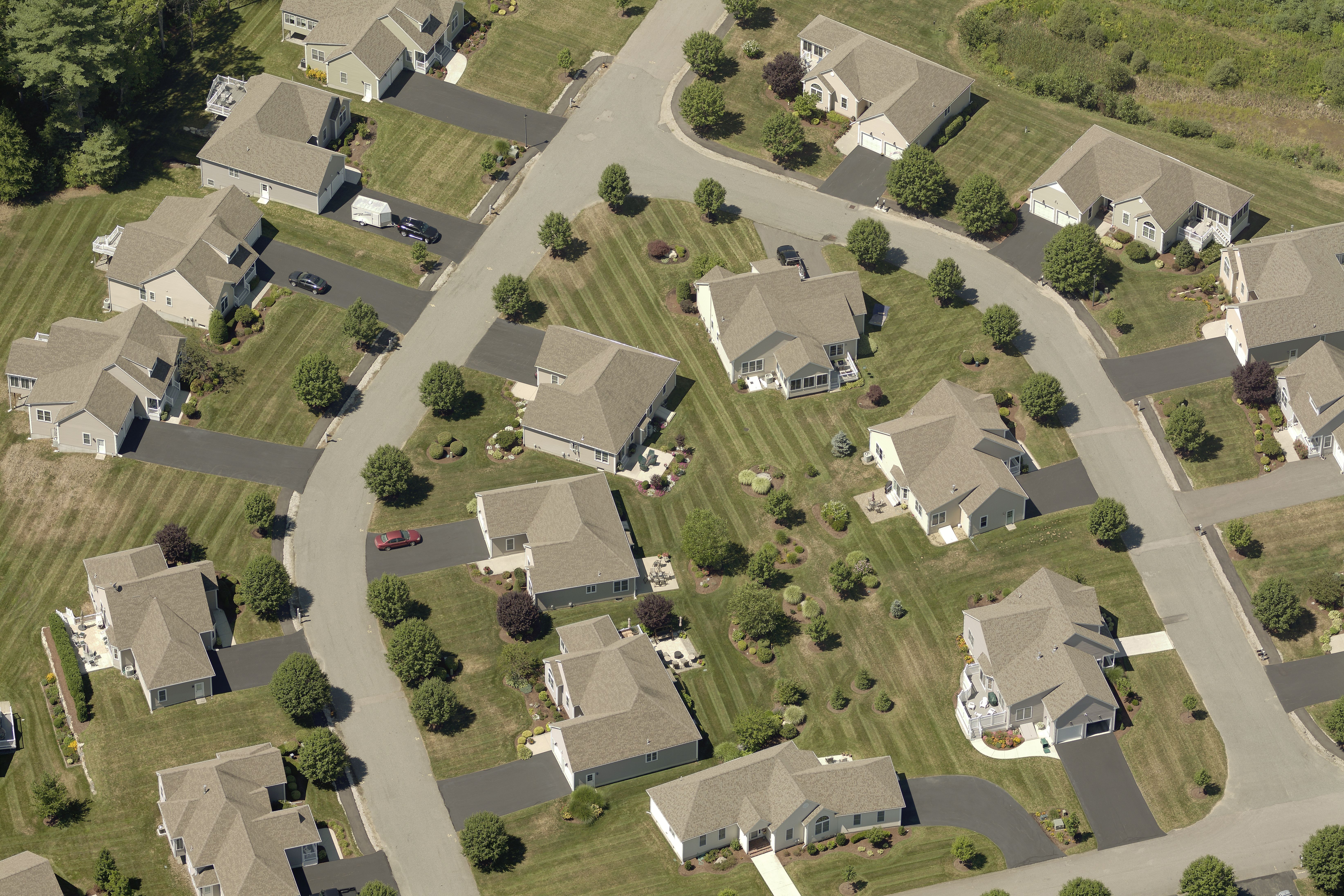
1-inch resolution imagery has transformed the way multiple departments in local government work. From public works assessments to traffic projects, appraisals, and weed control, the use cases abound for analyzing land and saving time in the field. However, the true time and cost savings brought about by 1-inch imagery may not be obvious to decision-makers at the top, which is where demonstrating its business use case is imperative.
On our upcoming webinar See the Difference: 1-Inch GSD Aerial Imagery for Local Government on Wednesday, August 7th, we'll speak to Mike Schonlau, GIS Administrator for Douglas County, NE, about how he was able to make the case for 1-inch imagery to county leaders and start leveraging its benefits throughout departments. Register for the webinar here.
The webinar will dive into:
- How to demonstrate the value of 1-inch imagery to government decision-makers.
- Specific examples of how 1-inch imagery saves significant time and money across local government operations.
- The types of use cases that are most applicable to 1-inch imagery and produce the greatest ROI.
Join us to get all the details on these real-life examples of how 1-inch imagery can improve efficiency and cut costs for your departments:
Public Works
1-inch resolution imagery allows public works employees to not just detect manholes but to identify whether they are city or utility manholes. They can even attribute specific materials like pipes connected to manholes — an impossible feat using 3-inch imagery.
The webinar will provide details on how 1-inch imagery also saves time and money associated with rework by giving public works teams exact information they need to accurately design improvements — preventing backtracking and redesign.
Planning
The difference between 3-inch imagery and 1-inch also makes an impact on transportation planning. Bike lane design is made easier, faster, and more accurate using 1-inch imagery that provides a clear view of curbs and other infrastructure. Planners can generate effective designs without having to physically go out and photograph the area.
Appraisal
1-inch imagery delivers significant time savings when it comes to field work in appraisal and assessments. Appraisers can accurately assess roof composition and siding material from their desks with such resolution. They can also clearly see items like AC units on a property, including important details about those units like equipment conditions and age.
Parks and Recreation
While 3-inch imagery provides a view of general equipment at a playground, 1-inch imagery shows exactly what equipment is in place and what its condition is. 1-inch saves Parks & Rec significant time from having to physically inspect park and playground conditions.
Weed Control
1-inch imagery is immensely helpful in controlling noxious weeds as workers can classify images to identify areas that contain certain types of noxious weeds. The imagery clearly depicts areas that were missed in spraying so you can effectively control invasive plants.
The Bottom Line: Greater Confidence, Lower Costs
Don’t miss this opportunity to hear from local government users about how 1-inch imagery helps them eliminate their need for field assessment and cut costs across the board. Register for the webinar here and join us to learn about more use cases for 1-inch imagery in local government and how to present the value of it to your decision-makers.