With relief efforts ongoing after Hurricane Harvey and Hurricane Irma, EagleView is continuing to help the affected areas recover with post-event image capture. News outlets have covered EagleView's post-Hurricane efforts, and EagleView's Randall Ishikawa appeared on a Google Hangout with the guys from
Drone & Sundry.
sUAS News
Last week, sUAS News, which is dedicated to “the business of drones,” republished our piece on
post-hurricane machine learning.
The
Drone & Sundry YouTube channel from sUAS News invited Randall Ishikawa, part of the insurance team here at EagleView, to take part in its live chat on “Drone Stuff This Week.”
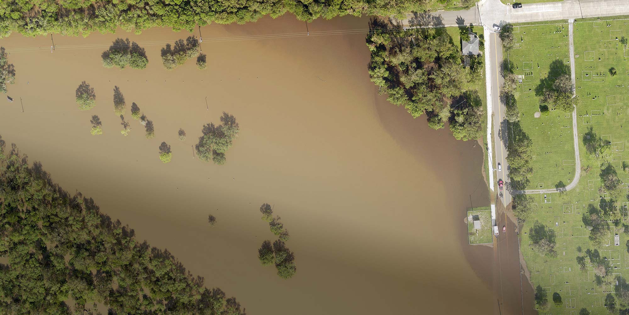
Randall shares how EagleView has been using drones and what role they’ve played in the relief efforts following Hurricanes Harvey and Irma. Not only have we been working with insurance carriers, he says, but we’ve also been helping government agencies, including those involved in emergency services.
EagleView is using aerial imagery captured by fixed-wing aircraft combined with images from drones and satellite to assist in disaster recovery.
EagleView OnSite, the storm and event solution from EagleView, brings this imagery to insurance claims adjusters, emergency services, and other professionals following a catastrophic event.
Randall also discusses the Hurricane Harvey imagery website from EagleView as well as the triage process for EagleView OnSite. How does EagleView OnSite determine the need for drone operators in place of a claims adjuster? Find out in
Drone & Sundry’s Hangout:
Geospatial News
EagleView also received mentions from
Geospatial Solutions and
GPS World.
ICYMI