Latest Patent Secures Method For Providing Customers With Early Access To Aerial Images
Bothell, Wash. (March 26, 2018) – Eagle View Technologies, Inc. (“EagleView®”), the leading provider of aerial imagery and property data analytics for the government, insurance and commercial sectors, today announced that it has secured its newest patent, U.S. Patent number 9,805,059. This “Early Access” patent covers technology that allows EagleView to provide customers with significantly faster access to aerial images post-capture.
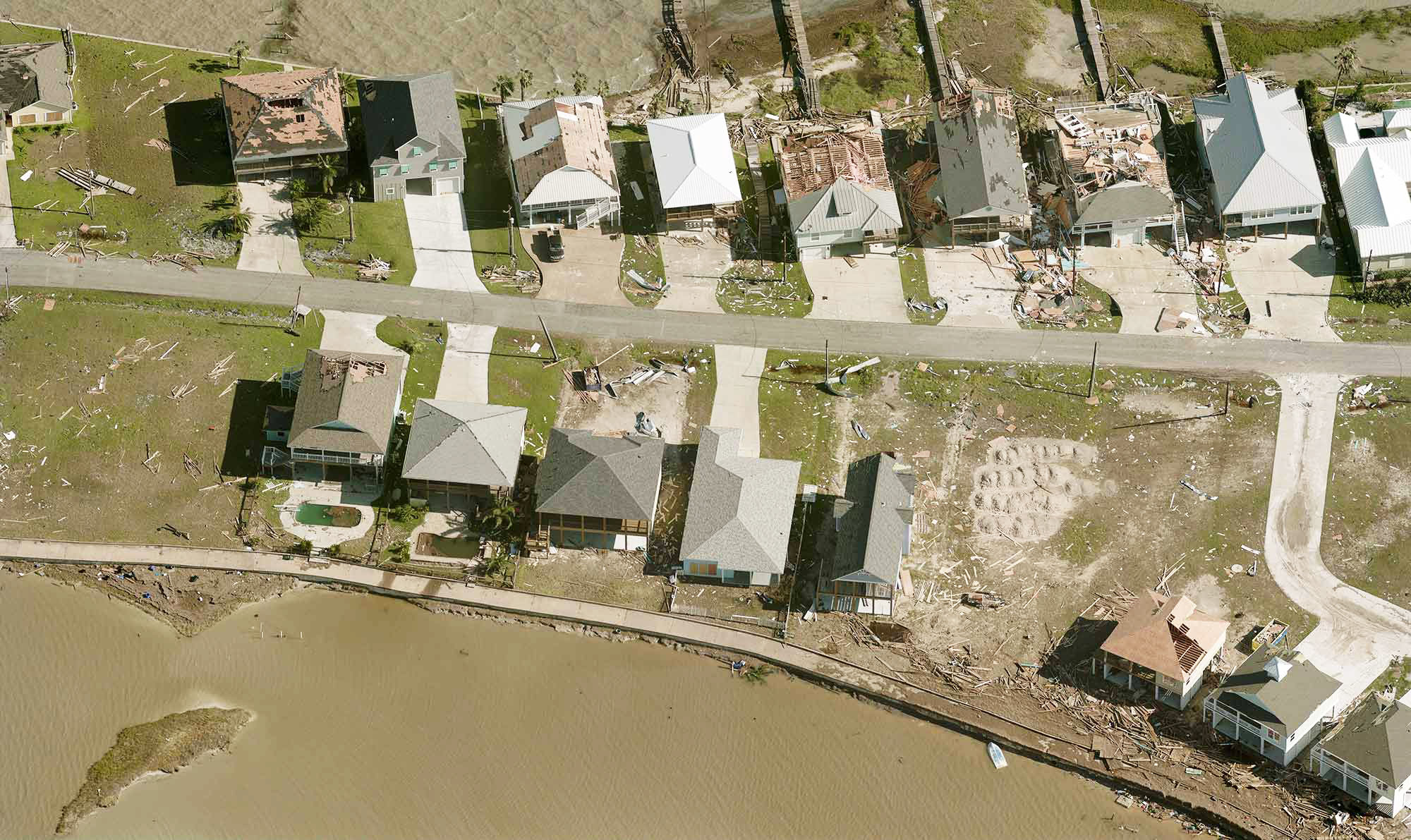
With both RapidAccess™ and EarlyAccess™ technologies, imagery is delivered to customers within hours after disastrous weather events or days for specially tasked flights. RapidAccess is critical to
emergency management following a catastrophic event, helping county officials with timely disaster response, in addition to adjusters in
property claims insurance as they respond to post-weather event claims. EarlyAccess also provides
assessors with the ability to begin processing property valuations within weeks of imagery capture, enabling them to quickly reevaluate properties and meet tax roll deadlines. With access to more than 125 fixed-wing aircraft to capture imagery across the country on any given day, EagleView delivers a level of response that no other aerial imagery provider can offer.
EagleView’s high-resolution
Pictometry® imagery, paired with innovations like EarlyAccess and advanced machine learning technology, enables insurers and government officials to quickly identify property or infrastructure changes from the desktop, respond safely to emergencies, and maintain more accurate data and records. This technology is used daily by almost every large county in the United States, with imagery that covers nearly 90% of the nation’s population.
“When disaster strikes, government officials and insurance companies are expected to be on the ground immediately. They don’t have time to wait for the full picture. This latest patent allows EagleView to begin sharing the first set of data and images with our customer in near real-time, so they can work faster and smarter when evaluating properties,” said EagleView CEO Rishi Daga.
Holding more than 145 total patents, EagleView is recognized across the country as an innovator and industry leader. EagleView supports numerous insurers and government functions, from helping to ensure fair and equitable valuations for property assessors and providing accurate location data across 9-1-1 communications departments, to recognizing post-storm damage on residential properties for rapid closing of property claims. In 2017, imagery and data analytics from EagleView aided both government and insurance companies in recovery efforts from natural disasters, including Hurricanes Harvey and Irma, and the
California wildfires and mudslides.
For more information about EagleView’s patents and software solutions, contact Melissa Mazurek at
melissa.mazurek@eagleview.com or 585-444-2504.
About EagleView
EagleView is the leading provider of high-resolution aerial imagery, property data analytics and structural measurements for government agencies, insurance carriers, roofing contractors and energy utilities. Using patented image capture techniques, 3D aerial measurement software and machine learning processes, EagleView helps customers answer questions related to millions of properties throughout the world. With a 60-petabyte library of oblique and orthogonal Pictometry® aerial imagery dating back to 2001 and the capacity to process tens of thousands of roof measurement reports per day, EagleView enables organizations to reduce field visits and adopt faster, safer and more cost-effective workflows. For more information, contact (866) 659-8439 or visit
www.eagleview.com.