As the Educational Program Manager at EagleView, Andrew Mendola brings geographic information systems (GIS) to educational institutions around the country. In honor of Geography Awareness Week this week and GIS Day tomorrow, Andy has plenty to say on the importance of GIS in education and in our everyday lives. Read the interview with Andy below.

Tell us about your background. What got you interested in GIS?
I came to EagleView almost 10 years ago with a background in education. I am a New York State-certified teacher and taught adult education and high school business for 14 years. I am also a certified NYS school administrator with two Master’s degrees in education.
I remember when I interviewed here I was asked what I knew about GIS. My answer, other than it is three letters in the alphabet, was that I knew nothing. I found our technology fascinating, and as a lifelong learner, I jumped right in and learned as much as I could. Getting involved with outside groups and talking to subject matter experts within our organization helped me gain knowledge that could not be found in a book.
How does EagleView help promote GIS in schools?
EagleView has a robust educational program. I work with colleges and universities across the country to help them integrate our technology into their curriculum. EagleView has become required learning, and the students utilize our data for research and for projects they are working on as part of their coursework. There are also many high schools teaching GIS now and several offer dual credit programs in partnership with a local college.
Which organizations do you work with?
Currently, I am serving as President of the NYS GIS Association. I also chair the Education Committee for the NYS GIS Association. I work with some of the most amazing GIS professors across the state who are always striving to keep up with the most cutting-edge technology. It is their job to keep their students informed of industry trends so their students are prepared to enter the workforce.
I also sit on the GIS/SIG board. GIS/SIG works to promote learning opportunities for GIS professionals in our local area. We host an annual conference each April that draws 250 attendees. Our own Frank Giuffrida, EagleView’s Executive Vice President and Chief Engineer, was the keynote for the 2015 conference.
I am a member of the National Visiting Committee for the Geotech Center based in Louisville, KY. The Geotech Center is funded by the National Science Foundation to promote GIS and Geospatial Technology in community colleges. They mentor and work with schools looking to start, grow, and enhance their current GIS educational offerings.
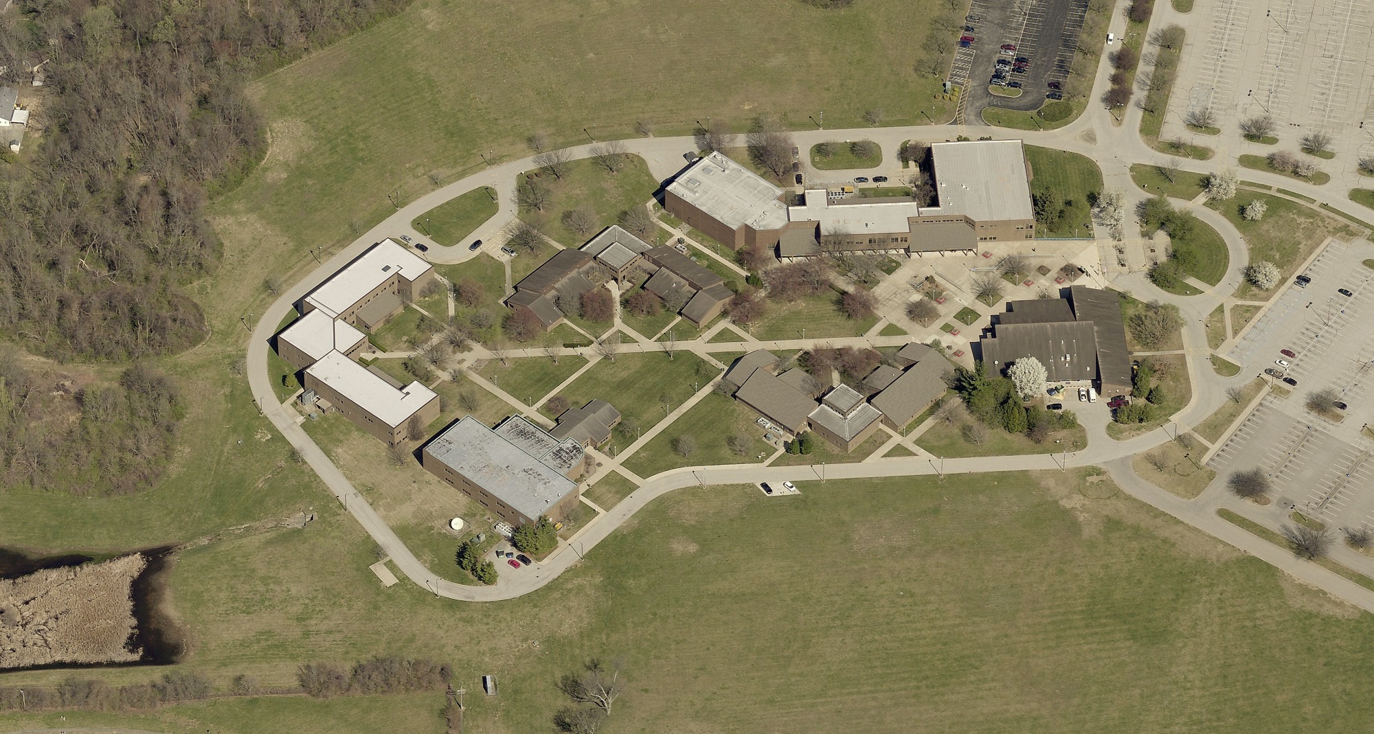
[See the Geotech Center pictured up top, building furthest to the right; image copyright Pictometry.]
This week we’re celebrating Geography Awareness Week and GIS Day. Why are these events—and GIS education—so important?
GIS is finally starting to receive the recognition that it deserves. You will be hard pressed to find a program in school today that isn’t touched by GIS in some way. GIS touches our everyday lives in ways people cannot imagine or in many cases, they have no idea what they are experiencing or doing is because of GIS.
What advice would you give to someone interested in beginning a career in GIS?
Learn as much about the field as you can. Join user groups and organizations with like-minded people. There are so many opportunities to network and find out how others are applying GIS, but you need to get involved.
You know you work in GIS when someone asks you what you do for work and your first thought is “Oh boy.” There is no elevator talk you can give someone that can answer that question quickly and concisely. If you have ever tried to explain to someone what we do and what GIS is, you know what I’m talking about.
Is there anything else you would like to add about your role at EagleView or about GIS?
I am working with EagleView’s Development and Engineering groups to help onboard the new members to the team. I share our history and give the new employees a sense of who are customers are and what they do with our technology.
I still love to teach and enjoy being on that stage. The excitement you can see and feel in the room when you are presenting and teaching students and faculty about who EagleView is and what we do is rewarding in ways that I cannot express.
Interested in bringing GIS and Pictometry® aerial imagery to your classroom? See our
Education page for more information and find out how to contact Andy.
Next up: hear from some
EagleView team members with GISP® certifications on their careers in GIS.