High-resolution aerial imagery of damaged areas, paired with artificial intelligence, enables rapid response
Bothell, Wash. (December 21, 2017) – Eagle View Technologies ("EagleView®"), the leading provider of aerial imagery and property analytics for the government, insurance and commercial sectors, has already captured and delivered high-resolution aerial images of the wildfire destruction in San Diego County to its insurance carrier partners. The high-resolution imagery, captured at 1.5-inch GSD (Ground Sample Distance), paired with EagleView’s artificial intelligence technology FireAI™, have allowed insurance carriers to start viewing and responding to areas of severe need before residents have even returned home.
EagleView is providing customers with the imagery and data through its web-based CONNECTExplorer™ platform at no additional cost in an effort to support the recovery process.
EagleView’s rapid-response approach to catastrophic events leverages the fleet of more than 120 fixed-wing aircraft at the business’s disposal. Using patented camera systems, EagleView captures its Pictometry® aerial imagery from a top-down (orthogonal) perspective as well as from an oblique angle, also known as a bird’s-eye view, allowing adjusters to see 360 degrees around a property.
“The images we’ve captured show a heartbreaking loss of property across San Diego County,” said EagleView CEO Rishi Daga. “Our hope is that EagleView’s ability to give our insurance customers the full picture through a process that is faster, safer, and at no additional cost will ultimately help families get back in their homes as soon as possible.”
In 2017, EagleView began implementing advanced machine learning technology to gather and analyze important data quickly. This technology helps EagleView identify areas with severe property damage to enable the triage of insurance claims quickly and efficiently.
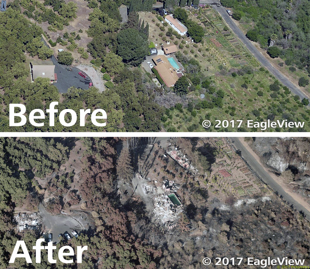
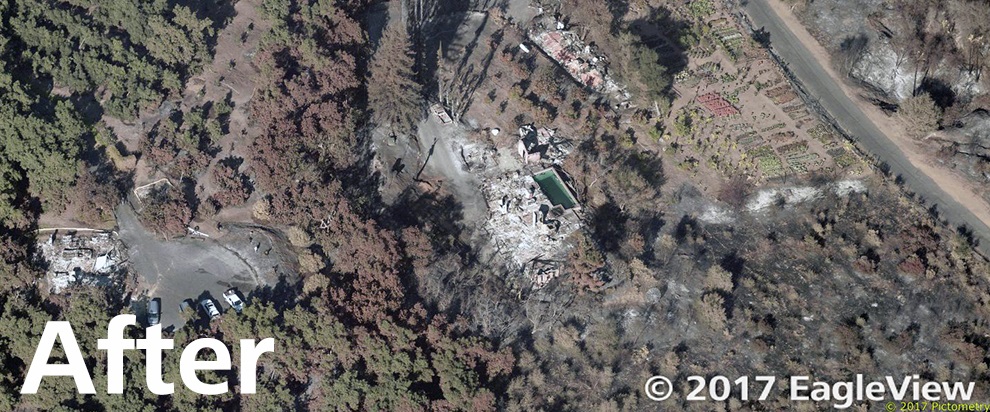
With EagleView's FireAI, insurance carriers have already been able to determine that 157 structures have been destroyed and 64 have been damaged within the total of 4,100 acres burned. Without EagleView providing this service, it would have been several more weeks before insurers could get on the ground to ascertain this level of detail and start processing claims.
EagleView will continue flying over the area of the Lilac wildfire as conditions allow until the fires are resolved. Adjusters will be able to view updated imagery in addition to the most recent pre-event imagery that EagleView has taken of San Diego County over the last 12 months, making before-and-after comparisons possible.
For more information on EagleView's deployment of aircraft, drones and other assets during the California wildfires, please contact Melissa Mazurek at (585) 444-2504 or
melissa.mazurek@eagleview.com.
About EagleView
EagleView is the leading provider of high-resolution aerial imagery, property data analytics and structural measurements for government agencies, insurance carriers, roofing contractors and energy utilities. Using patented image capture techniques, 3D aerial measurement software and machine learning processes, EagleView helps customers answer questions related to millions of properties throughout the world. With a 60-petabyte library of oblique and orthogonal Pictometry® aerial imagery dating back to 2001 and the capacity to process tens of thousands of roof measurement reports per day, EagleView enables organizations to reduce field visits and adopt faster, safer and more cost-effective workflows. For more information, contact (866) 659-8439 or visit
www.eagleview.com.