Roofing contractors require accuracy when using aerial measurements for bidding, estimating and planning production. Incorrect measurements can translate into hundreds or thousands of dollars lost on a job.
The resolution and timeliness of the aerial imagery that is used to derive the measurements is a key factor in the accuracy. Buildings undergo constant change and when an aerial image is not current, the possibility that a piece of the structure has been added or removed is unforeseeable, leaving the contractor’s measurements useless.
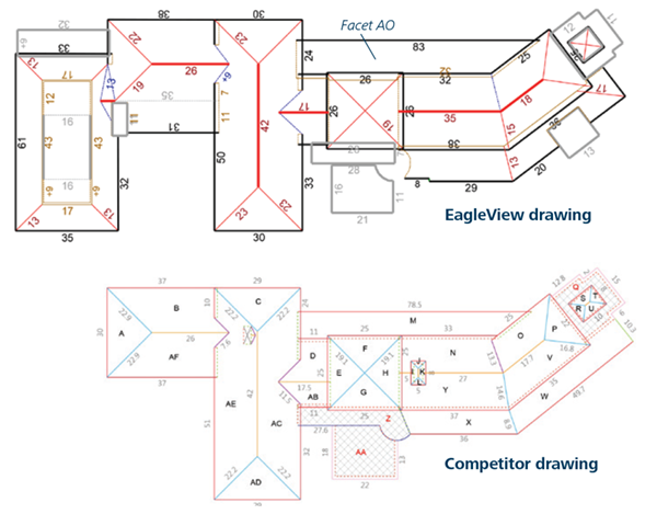
Recently, an EagleView competitor delivered a measurement report to a contractor that was derived using satellite imagery freely available on the internet that was captured in 2014. EagleView measured that same property using 2015 Pictometry® Intelligent Imagery® along with its patented 3D technologies and found that the competitor’s report was short by 34 squares. How is it possible to be so far off?
Read the case study to find out more.