Learn how oblique aerial imagery can help tax assessors work more efficiently and inspect more properties in less time.
Assessors Face Multiple Challenges
Assessment departments are charged with providing fair and defensible property valuations, delivering an equitable tax roll, and maintaining positive relations with constituents—all while keeping their teams safe and productive.
But with limited staff available to conduct on-site visits, assessors often find themselves struggling to “hit their numbers” without sacrificing quality.
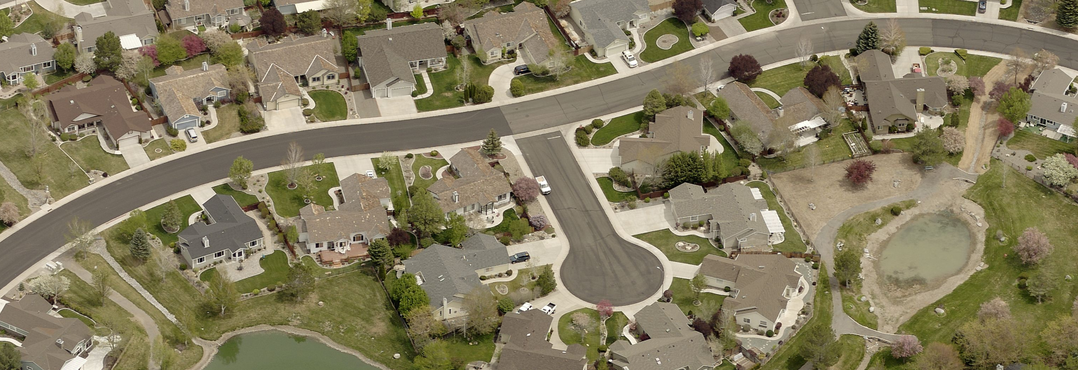
Field visits are inherently time intensive, especially in large rural counties with remote or difficult to access properties. When you add up the hours required between travel and each actual inspection, an assessor could end up covering just a small handful of properties per day.
In addition to the inefficiency of traveling in person to each location, field visits can potentially place assessors at risk, both to their personal safety while traveling and conducting physical inspections, as well as their health as they come into close contact with residents. On-site inspections can also be an imposition on homeowners’ right to privacy, some of whom may not want assessors on their property.
EagleView's Oblique Aerial Imagery Can Help
To improve efficiency and minimize risk, many counties have embraced “desktop assessments,” leveraging EagleView's oblique (side angled) aerial imagery to calculate the value of parcels and stay on top of new construction. With EagleView's oblique aerial imagery, assessors can review property details from anywhere, without having to visit the residence and inspect the property in person.
EagleView's oblique aerial imagery provides high-resolution views from all four cardinal directions of a structure. This allows assessors to see exterior improvements, take exact external measurements, overlay parcel lines, assign accurate property valuations, and view other important context and detail—even for properties that are difficult to view from the road, or that are blocked by trees and other obstacles.
This guide will explore the benefits of EagleView's oblique aerial imagery for tax assessors, including:
- Increasing efficiency with remote property assessments.
- Identifying additional taxable value.
- Integrating aerial imagery with their existing workflow.
Increase Efficiency
EagleView’s oblique aerial imagery enables assessors to view properties remotely, detect changes, and calculate parcel value far more quickly than with traditional site visits.
Rather than having to go into the field, aerial imagery brings the world to the inspector, allowing for accurate property assessments right from their desk. This helps assessment departments:
- Meet assessment deadlines and achieve department goals.
- Decrease costs by eliminating unnecessary expenses from vehicle wear and tear, fuel, and staffing needed for field visits.
- Efficiently cover large areas. Compared to more densely populated urban areas, large rural counties with a relatively low concentration of properties pose unique challenges and a lower return on time invested for conducting on-site assessments.
- Keep up with growth. For assessment departments in fast growth areas, conducting on-site inspections and measurements for hundreds (or even thousands) of new houses and buildings per year would be impossible.
Identify Additional Taxable Value
Counties can leverage high-resolution property views and change detection solutions to uncover taxable property value, resulting in additional revenue for their county.
Discover Undocumented Structures and Unreported Real Property Market Value
In order to conduct fair and equitable assessments on all properties in the region, inspectors need to know about newly added porches, garages, pools, living areas, and other structures that may increase the taxable value of a property.
While the permitting process provides insights into real property changes that trigger additional market value, unreported construction and improvements leave counties unaware of non-permitted improvements that don’t reflect on the tax roll. Property owners who don’t file construction permits for new improvements, structures, and expansions typically do so to avoid paying higher taxes.
Using EagleView aerial imagery, Mohave County, AZ, found and added over $95 million in market value, translating into an additional $352,000 of annual tax revenue. Las Animas County, CO, used EagleView aerial imagery covering just one-third of the county to discover $14 million in actual value from new construction.
Discover Undeclared Personal Property
In addition to real property, aerial imaging is also useful for discovering unreported or undervalued personal property like boats, RVs, and vacation rentals.
Dare County, NC, used EagleView aerial imagery to discover about $50 million in assessed value just in watercraft—some being undervalued at rates as low as $20—adding $235k in revenue for the county.
The area also has a high demand for vacation rentals, which don’t always get reported by property owners. Temporary rental platforms like AirBnB and Vrbo don’t submit lists of their rentals and locations to local governments, and matching listings for personal property appraisers is very difficult and time-consuming. Using aerial imagery, Dare County created layers that cross-referenced rental ads, helping appraisers find unreported vacation rentals.
Integrate With Your Existing Workflow
EagleView aerial imagery can be integrated with your existing assessment workflow and accessed directly within your Computer-Aided Mass Appraisal (CAMA) platform.
Assessors can use automated tools like ChangeFinder™ and Sketch Inspect to detect changes to a property, identify unpermitted construction, and stay current with construction and remodeling projects within their county.
EagleView ChangeFinder™
EagleView ChangeFinder™ from EagleView makes property assessments easier and faster by automatically detecting property changes from year-to-year. Using GIS polygon outlines for analysis of changes in size and shape, the platform compares property imagery from the last capture to the most recent capture, and highlights the areas with the most changes, helping assessors:
- Prioritize their focus by quickly reviewing properties most likely to need adjustments in valuation, or that may require more in-depth investigation
- Filter what they’re looking for when searching parcels, and view properties from different levels and perspectives
- Increase revenue by discovering previously undetected improvements
- Support the appraisal and provide defensible proof during an appeal
EagleView Sketch Inspect™
EagleView Sketch Inspect™ leverages high-resolution aerial imagery and an automated algorithm to quickly show assessors the inaccuracies that matter the most. Assessors can verify and update property sketches using an automated process to compare building outlines to CAMA sketches, as well as maintain sketches of properties (building outlines) for accurate valuations.
- Streamline workflows and reduce information bottlenecks with automated sketch verification algorithms.
- Create seamless work orders to address issues including office, GIS, and field inspection tasks.
- Easily find sketches that don’t match what's on the ground, including missing sketches.
- Sort, filter, review, track, and flag parcels with discrepancies using the web-based interface.
Public Access to Aerial Imagery Data
To help increase transparency and build trust with constituents, counties can share EagleView aerial imagery with the general public using a variety of public-facing portals, interactive maps, and mobile apps that include aerial photography and parcel data. Homeowners can log in to see their property valuations, as well as the high-resolution imagery used to reach that valuation.
Having extremely clear and precise imagery helps improve transparency, increase public trust, and ensure equitable appraisals for constituents. By providing the information homeowners need to understand valuation assessment methods and decisions, counties can reduce the number of customer complaints and appeals regarding the validity of valuations.
Get Started Today
To learn more about how EagleView solutions can help meet your department's needs or to request a demo, visit https://www.eagleview.com/industry/government/.