
Over the past 25 years of providing high-resolution aerial imagery to government organizations, we’ve often found that Assessors lead the way in adopting new technology to better serve their communities. That’s why we’re excited to be heading to Salt Lake City to showcase the newest EagleView solutions for assessment departments at the 2023 IAAO Conference!
EagleView’s high-resolution aerial imagery and accurate property data help assessors make informed and confident decisions. Using sophisticated cameras and flying at low altitude, we capture clear and detailed images that show a property’s condition and the types of building materials used, from both top-down and side-angles—making property analysis easier. Plus, our aerial imagery integrates with leading CAMA systems, helping ensure that your valuations are based on the most accurate property data available.
If you’re planning to attend, be sure to join us for one of our speaking sessions to get a firsthand look at our newest sketch verification solution for Assessors—Sketch Inspect. You’ll also have the opportunity to hear from our long-time customers in King County, Washington, on how high-resolution aerial imagery makes commercial property assessment easier. Plus, stop by Booth #309 for daily live demos!
See how you can connect us with us during the event:
 Exhibitor Showcase
Sketch Inspect: Faster, Easier Sketch Verification
Monday, August 28 | 10:30 a.m. | Room 150 A
Presenter: Elliott Cox, EagleView
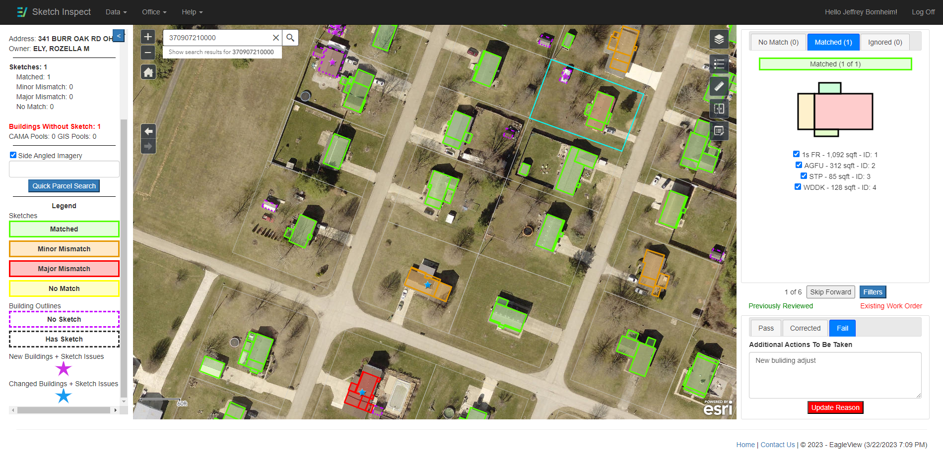
Faster, easier sketch verification is finally here! Sketch Inspect, a new software solution from EagleView, is revolutionizing property sketch verification. Using machine learning and powerful computer algorithms, Sketch Inspect superimposes property sketches from a CAMA system on top of aerial imagery, helping assessors find properties with inaccurate and missing property sketches and prioritize which properties to update.
Thought Leader Session
See More From the Air:
Commercial Property Assessment Becomes Easier With High-Resolution Aerial Imagery
Monday, August 28 | 1-2 p.m. | Room 150G
Presenters:
- Doug Tonnemacher, Moderator, EagleView
- Megan Reilly, EagleView
- John Wilson, King County, WA
Because of parking facilities, varied lot sizes and other design features, commercial properties can be more difficult to assess than residential properties. Aerial imagery provides a helpful view of those features. Plus, the measurements and data embedded in aerial imagery are extremely accurate.
Using imagery, assessors can reduce, or even eliminate, time-consuming and costly site visits, while also maintaining fair and equitable tax rolls. Hear real-life examples of counties using imagery to improve the commercial assessment process.
Exhibit Hall: Booth #309
Monday, August 28-Tuesday, August 29
Stop by our booth for a live demonstration of our aerial imagery products and use cases for residential and commercial property assessment. Check out our demo schedule:
Using EagleView to Make Sketches Less Sketchy
Monday, Aug 28
2:30-3 p.m.
Leveraging Oblique Imagery to Update Property Record Card Photos
Tuesday, August 29
10:30-11 a.m.
Stop by during exhibit hours to hear about these topics or any of our other assessment solutions on-demand!
We hope to see you at IAAO 2023, and can’t wait to connect with the assessment community in Salt Lake City.
To learn more about EagleView’s high-resolution aerial imagery and the top use cases for property assessment, read our new guide, The Benefits of Oblique Aerial Imagery for Assessment.