The
Auditor’s Office in Clermont County, Ohio, is proactive about developing technology that is unique to their county and constituents. At the core of many county solutions is
EagleView® imagery, formerly known as Pictometry
®.
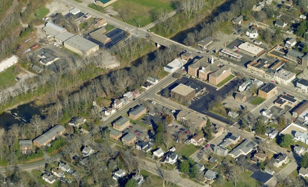
More than two-thirds of the 88 counties in Ohio use EagleView's imagery. For Clermont County, the imagery is part of a robust tech stack that dates back more than 10 years.
Streamlining Operations for a More Efficient Workflow
The
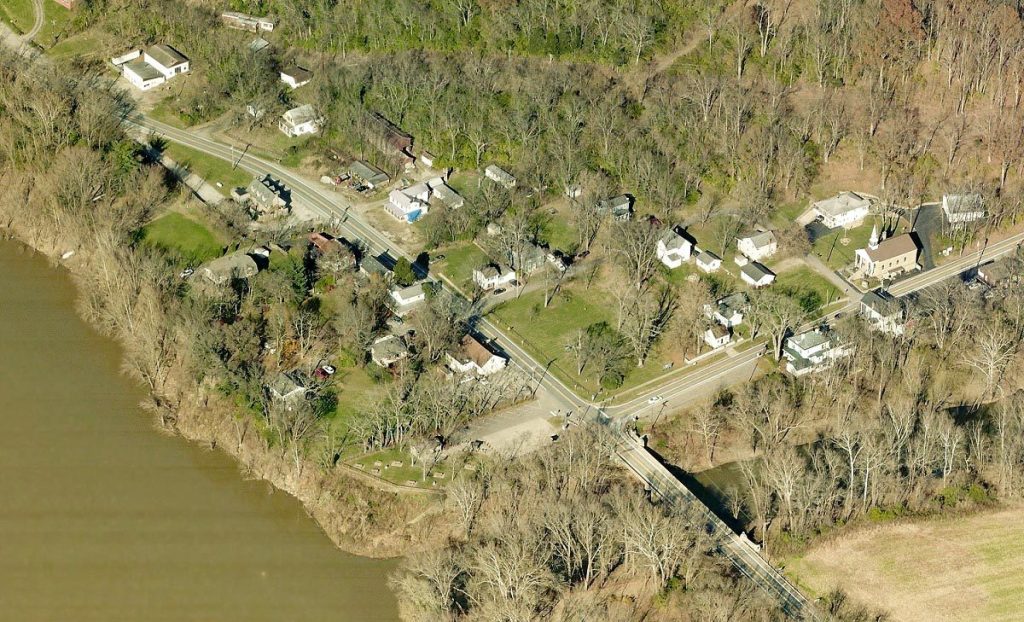
Clermont County Auditor’s Office began using aerial imagery from EagleView in 2006 for assessment purposes. With a high-resolution view of the county from the top-down and all four cardinal directions, the imagery became a staple for many county offices.
With increased demand for imagery and mapping solutions, the county created a Geographic Information Systems (GIS) department to manage the data. The auditor’s office also developed its own dedicated GIS team.
Like many other valuation officials throughout Ohio and the rest of the United States, Clermont County Auditor Linda Fraley is quick to point out the benefits of having EagleView imagery for her jurisdiction.
“The imagery is ingrained in the way we do business,” Fraley said. “We used to have two people out driving the roads. EagleView imagery saves time and money by giving personnel accurate property data so that field inspection is minimal.”
Fraley’s department is responsible for valuing roughly 97,000 parcels over a 460-square-mile area—no easy task! Existing properties are reassessed every six years on a rolling basis, and the department completes a statistical update of properties in the county every third year.
The population of Clermont County has more than doubled since 1970, according to U.S. Census data. Using aerial imagery and other technology helps the Auditor’s office view and value new constructions each year as the county continues to grow.
Innovating New Solutions to Get Better Data

Linda Fraley, Auditor for Clermont County, Ohio
To track changes and get a real-world view of parcels, Fraley and her staff deploy a variety of unique technology solutions.
Fraley’s department uses a proprietary combination of imagery and data to support the
Current Agricultural Use Valuation. The program helps reduce taxes for agricultural businesses by valuing farmland on soil type rather than market value or other factors.
“With this program, people get a reduction in taxes if they use the land for farming, and we’re able to check this with aerial imagery,” said Mark Harp, Deputy Auditor and GIS Director for the Clermont County Auditor’s Office. “The
GIS department in the Auditor’s office developed an in-house application to determine what land is tillable, how the land is used, and what the soil layer is based on state data for each parcel. We use EagleView imagery to get a realistic view of these areas.”
With such powerful imagery and data, the county’s auditing and GIS functions can promote an accurate worldview across the county. “We have a GIS department and share the imagery with them,” Fraley said, “and it’s used throughout the county.”
According to Fraley, townships across the county use imagery from EagleView. So does the County Sheriff. Public safety agencies throughout the U.S. typically use EagleView's imagery in 9-1-1 communications departments to verify caller locations and direct first responders to emergencies.
Encouraging Transparency in the Information Age
“We’re out there doing some things that other agencies aren’t doing,” Fraley said of her department’s innovations. “But we don’t keep them to ourselves. We also share the information with our constituents.”
The Auditor’s office hosts a variety of
interactive maps on its website. The county also has its own free mobile app that includes aerial photography and parcel data. According to Harp, local real estate agents use the app regularly to obtain property information.
The imagery also comes in handy when property owners have questions about their valuations.
“Last year was the statistical update for the county,” said Harp. “We expected between 800 and 1,000 appeals—a typical amount—but wound up with only about 420 case files.”
When Fraley’s office met with property owners, staff members were able to show them what they could see in the imagery.
“We pull up EagleView's imagery and show them surrounding areas,” Fraley explained. “We can show them how much we know about their property, and they’re kind of impressed. They clearly understand how we get our information and reach a decision.”
Before using imagery from EagleView, the Auditor’s Office was able to achieve the number of reassessments mandated by the state. “We could hit our numbers but couldn’t get good quality assessments,” Fraley said.
Today, EagleView imagery brings Fraley and her team confidence in their assessments. “The valuations are more accurate with EagleView imagery,” Fraley said. “You get an overview so that you don't have any discrepancies with valuations.”