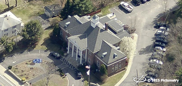
A township that covers 26.7 square miles with approximately 8,000 parcels would not seem a likely candidate for needing aerial imagery in the eyes of some jurisdictions. But when you are the Town of Smithfield, Rhode Island, the town officials had big dreams that included utilizing the power of technology to take care of this beautiful north-central Rhode Island town.
“It is about working smarter not harder,” stated Suzanne Kogut,
Tax Assessor for Smithfield. “I have been a proponent of Pictometry [imagery] since our first flight in 2006 and it has nothing to do with the size of our jurisdiction but how well we serve our constituents. All jurisdictions should have aerial imagery and solutions for their governmental departments.”
EagleView has not only led the revolution of using aerial imagery for local, county and federal governments but they invented the method to obtain oblique imagery which is captured at a 45-degree angle. The importance of this imagery is the ability it provides to view properties from all directions, including straight down, in order to capture and retain important property data.
As past president of the state assessor association which has 39 towns and subsequent assessors, Kogut advocates for her fellow assessors to incorporate the use of Pictometry imagery and software. “In Smithfield we depend on the imagery for re-valuation which we do every three years as the state mandates,” said Kogut. “With Pictometry [imagery], we can verify changes to properties using the imagery at our desk through the cloud. Before we would have to drive by the property and it just did not give us enough information; Pictometry [imagery] does.”
“The return on investment has been significant in the savings we have seen in staffing,” continued Kogut. “We are now able to do more with less people and very few, if any, drive-bys. We do the field reviews at our desk with Pictometry [imagery] using the
CONNECT™ platform. My time alone has been cut substantially so that now I can focus on new technology projects that will continue to save the community money.”
Kogut also serves as the GIS committee chairperson for Smithfield and she has continued to be the advocate for the company’s GIS solutions like PictometryOnline, now replaced with CONNECTExplorer. “It is my goal that every department can use this technology,” continued Kogut. “The town is currently using it for public safety, planning and engineering. There is no question that all the departments love it. They see the value and every year we get more people involved.”
“In the end it is about doing more for your constituents by using technology to build scalable and sustainable systems,” concluded Kogut. “I have attended Pictometry’s FutureView conference and users groups so we can always be on the cutting edge of technology solutions. That is what it really means to serve your community, no matter the size.”