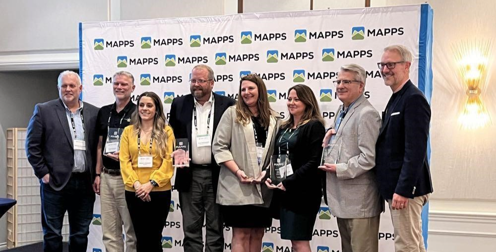
- Eagleview Partner Strategy Manager Brianna Zumhof (third from left) and Professional Practice Group Senior Director Carl Schoenthal, P.E.(fourth from left), with MAPPS Geospatial Excellence Award Winners
February 2025 | News, Innovation, Aerial Imagery
Eagleview is honored to be recognized with the MAPPS Geospatial Excellence Award in the Technology Innovation / Licensed Data Product category for our 1-inch Ground Sample Distance (GSD) imagery. This award highlights our continued commitment to pushing the boundaries of geospatial innovation and delivering high-resolution aerial imagery that transforms decision-making for governments and businesses alike.
 - 1-inch GSD image of Lucas Oil Stadium in Indianapolis, IN
Revolutionizing High-Resolution Aerial Imagery
Eagleview’s 1-inch imagery represents a breakthrough in scalable, high-resolution data capture. Traditionally, 1-inch resolution was limited to small-area projects, requiring significant time and resources for processing. However, through advancements in capture methodology and processing algorithms, Eagleview now delivers 1-inch imagery across entire cities, counties, and even states, as efficiently as lower-resolution products like 3-inch and 6-inch imagery.
 - 3-inch GSD image vs. 1-inch GSD image
With 9x more pixel data than 3-inch imagery, 1-inch GSD enables unparalleled detail, supporting applications in property assessment, infrastructure planning, emergency response, and AI-driven analytics. Our proprietary camera systems and advanced data processing workflows allow us to capture and deliver this vast amount of imagery with industry-leading speed and accuracy.

Innovative Technology for High-Precision Data
Our latest advancements incorporate automated aerial triangulation and Markov random field techniques to improve image segmentation and accuracy. By refining our processing algorithms to better analyze image metadata and spatial context, Eagleview ensures that 1-inch imagery maintains a seamless, high-quality appearance across expansive areas.
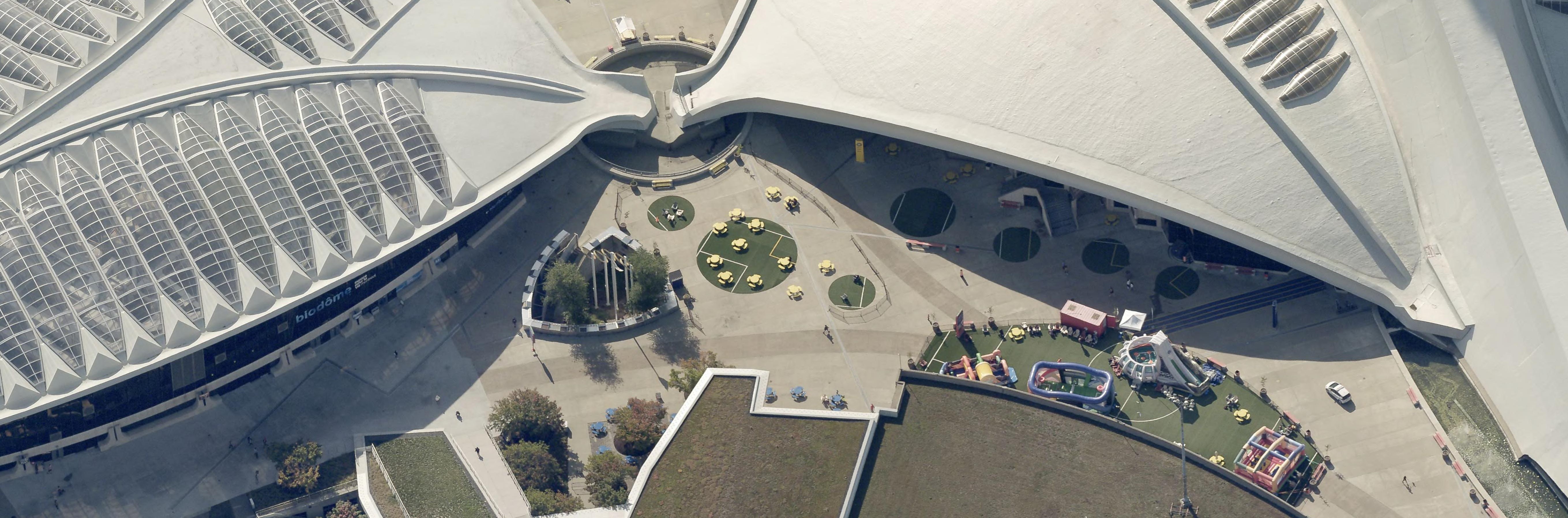 - 1-inch GSD oblique image of pavilion and playground outside of Montreal’s Olympic Stadium.
Additionally, the depth of detail in 1-inch imagery makes it an essential dataset for AI and machine learning applications, supporting automated feature extraction, change detection, and predictive analytics that will shape the future of geospatial intelligence.
 - Graphic showing the implications of 1-Inch GSD aerial imagery when training AI models. All imagery is composed of pixels and each pixel can only have one value. When using lower resolution imagery, there are fewer pixels available to differentiate detail. When using 1-Inch GSD imagery, there are more pixels available to capture detail and data. Models trained on 1-Inch imagery may have more validity and accuracy as a result.
Winning this award underscores the growing importance of high-resolution imagery in modern geospatial applications. Whether it's aiding emergency responders in assessing post-disaster damage, helping local governments streamline property assessments, or enabling AI-powered insights, Eagleview’s 1-inch imagery is redefining expectations for aerial data.
We’d like to congratulate our fellow MAPPS award winners—Tetra Tech, NV5, Dewberry, and Aero-Graphics—for their outstanding contributions to the industry.
Experience Award-Winning 1-Inch Imagery
Want to see what makes Eagleview’s 1-inch imagery stand out? Learn more and request a demo today: Request Demo