Does it feel like your agency is operating in a silo? Put another way, does it seem like every department in your jurisdiction uses a different solution to accomplish startlingly similar tasks?
If so, you’re not as alone as you might feel. It’s common to see different departments or offices use varying solutions in any organization—government entity or otherwise!
But sharing is caring, as they say, and it’s time to take those silos down. Fortunately, getting everyone on the same page technology-wise is easier than you might believe. Use this three-pronged approach to spread new technology and greater efficiency throughout your entire jurisdiction.
1. Evaluate your agency’s needs
The first step is to determine your office’s day-to-day struggles. As a leader in your organization, you are likely already familiar with your office’s strengths and weaknesses. However, that doesn’t mean you can’t crowdsource. Get your team together for a brainstorm and list their suggestions as well.
Some questions you might consider as you work together include:
- How long does it take to complete different day-to-day tasks?
- How much can you and your staff do in a typical day?
- Which issues do constituents bring to your office the most?
- What most frustrates your staff members?
- Where could your workflow become more efficient?
Once you’ve answered the questions, list the most serious recurring issues and prioritize them according to their urgency.
2. Bridge the gap between departments

No man (or agency) is an island.
Finding out what your colleagues are doing can be as simple as sending an email, picking up the phone, or walking across the hall.
You may find that other departments share the same struggles as your own. Ask them how they are solving their problems, and you might discover that you already have access to the solutions you need. Reach out to your jurisdiction’s
GIS or IT department to ask about the tech stack they have available.
If the right technology isn’t in place for your offices, however, it may be time for you to band together with other departments. That strength in numbers may convince stakeholders that jurisdiction-wide problems will require innovative new solutions to solve.
3. Explore the solutions available
How do government agencies use technology to perform their day-to-day responsibilities?
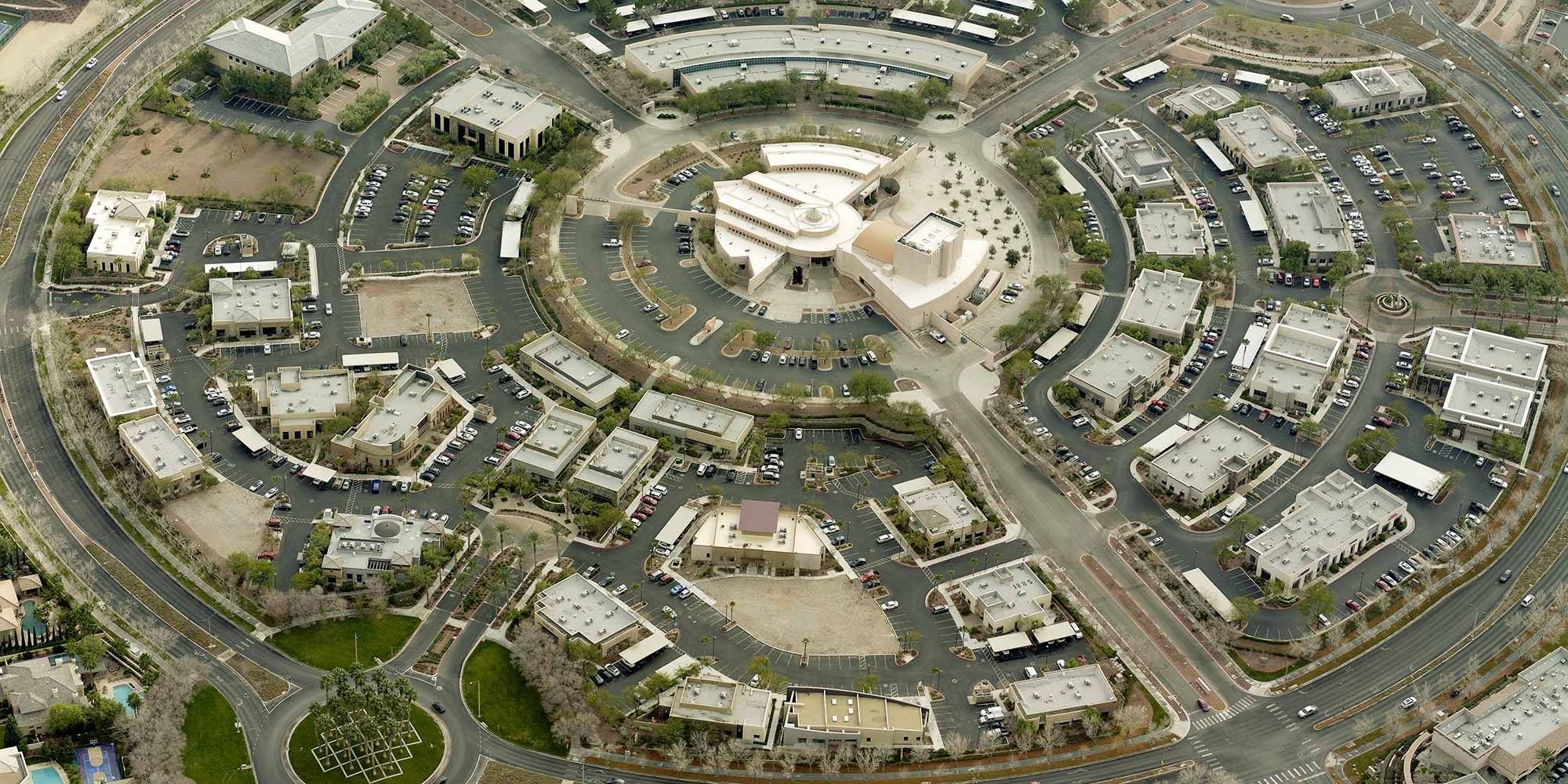
One thing that just about every department has in common is the need to understand and derive data from a particular location. Agencies can accomplish this through the use of imagery and geospatial data. High-resolution aerial imagery can
reveal details that would take far more work to gather on foot.
The same imagery can bring better outcomes different organizations. Although officials across departments are using the same resources, they can extract different data points that enable them to enhance what they do and how they operate.
It’s not uncommon for a
dozen or more agencies to share imagery and GIS data. Getting buy-in from other departments can help an office share costs and provide better answers to others in their jurisdiction.
As you explore different tech solutions, you might consider appealing to decision makers in:
GIS
Geographic Information Systems departments are often charged with providing imagery, mapping data layers, and other geospatial information to other agencies.
Assessment
Assessment and appraisal officials can view and analyze properties using imagery and GIS data to complete fair and equitable remote property valuations.
Public Safety
Public safety personnel--including E9-1-1 call takers and dispatchers, law enforcement personnel, fire departments, search and rescue teams, and emergency management offices--use imagery and data to respond to and prepare for emergencies and plan for critical missions in the field.
Planning & Zoning
Planning & Zoning departments can review structures to identify code violations, track zoning permits, make parcel changes, and manage growth in their jurisdiction.
Public Works
Public Works personnel can use imagery to identify infrastructure elements, such as roads and bridges, in need of repair.
And more
From county engineers to local school districts, every agency can benefit from a more robust tech stack that includes high-resolution aerial imagery and property data.
By working together with your peers in government, you can remove the silos that prevent collaboration. When everyone has the right data, they can see greater efficiency and consistency across all functions of government.
See the difference that the right imagery and data can make across agencies.
Download our guide to promoting the use of imagery across your jurisdiction.