Roundup: EagleView in the News – November 2017

GIS Day in Charleston County
Brenda Wheatley, GIS Coordinator for Charleston County, South Carolina, wrote about the county’s GIS Day training session with EagleView. With her permission, her writeup in the County Courier Newsletter appears below:
National GIS Day
By Brenda Wheatley
Wednesday, November 15, 2017 was national Geographic Information Systems (GIS) Day. GIS is a system designed to capture, store, manipulate, analyze, manage and present spatial or geographic data.
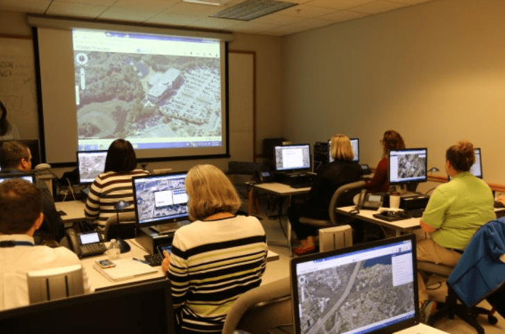
Charleston County participated in GIS Day, organized by Brenda Wheatley, Charleston County’s GIS Coordinator. Several training sessions were conducted covering the functionality of Pictometry CONNECT for users in the Assessors’ office, Building Services, Planning and Zoning, Public Works, Sheriff, DCA Administration, and Economic Development, along with Town of Mt. Pleasant and City of Charleston. Pictometry provides oblique imagery (bird’s eye view) and orthophoto (top down) imagery.
With the integration of our GIS database and Pictometry imagery, County users are able to provide more accurate information on building locations, building heights and dimensions, parcel configurations, true ground elevation and contours, and comparisons in high growth areas based on the imagery history.
With the use the Mobile App, any user has the data available in the field, providing a live connection to the imagery and the county’s GIS database.
EagleView Technical Trainer Courtney Dobbertin was on-hand to instruct representatives from various Charleston County agencies. Here are pictures from the event:

See what else EagleView was up to during Geography Awareness Week and GIS Day on the blog.
Eye in sky will help Renville County enforce buffer law
Renville County is turning to an eye in the sky to help it enforce Minnesota’s new buffer law.
Pictometry of Rochester, N.Y., will be providing the county with enhanced aerial images of the entire county. The company’s computer software will layer the images with LiDAR, or Light, Detection and Range survey data. With a few clicks of a computer mouse, county staff will be able to accurately assess whether individual properties are in compliance with the law.
“It should be a massive time saver,” said Larry Zupke, county drainage inspector.
Renville County has 151 ditch systems. There are 767 miles of open, public ditches that will require an estimated 3,000 acres of buffers. The county also has miles of public waterways where buffers are required.
Read more about how EagleView is helping Renville County, Minnesota on the Duluth News Tribune website.
Cost Savings in Montrose County with Pictometry Imagery
Technology one Montrose County commissioner likened to “Google on steroids” is more than merely impressive — it also saves other local governments and county departments time and money.
Pictometry International Corp. provides aerial imagery services to the county and on Nov. 8 won a contract extension through 2024. But pictometry goes beyond aerial imagery; it is so enhanced that it can locate outbuildings and other structures that should be on the county tax rolls.
“This is high-resolution, low-altitude imagery,” Montrose County Assessor Brad Hughes said Friday. “It’s oblique imagery, meaning we can view all four sides of a property.”

