Any development team regardless of size can now evaluate Eagleview’s high-precision property intelligence on up to 30 properties, free, with no credit card and no time limit. Self-serve trials for imagery and measurements to follow.
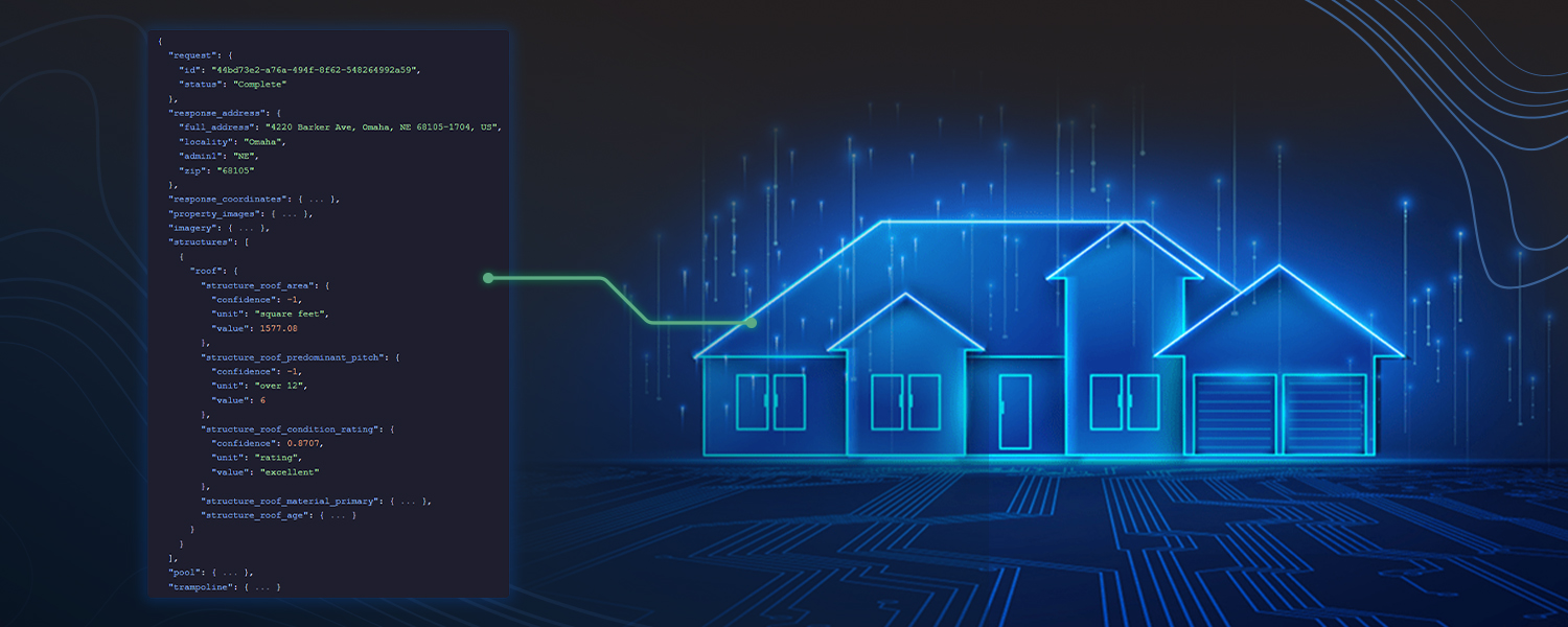
ROCHESTER, NY — [September 2, 2026] — Eagleview, a leading provider of geospatial intelligence, today announced free self-serve developer trials of its Eagleview One™ platform, beginning with property data. Developers can sign up in minutes and start querying data on property features, measurements, risk indicators, structure geometries, and condition insights extracted in near real-time from the most trusted and largest high-resolution aerial imagery archive in North America.
Free self-serve trials are the latest milestone in Eagleview's commitment to accelerating geospatial innovation for developers. Since launching its developer portal in 2023 - a free, unified gateway to Eagleview's APIs, sandbox environments, and technical resources - the company has steadily expanded its developer ecosystem. Built on the AI-driven property analytics platform Eagleview One, this ecosystem includes Eagleview Labs, a dedicated R&D center where developers co-create next-generation geospatial solutions powered by the company's 25-year imagery vault. Eagleview Horizon, the forthcoming agentic geospatial intelligence engine, is one of the innovative solutions developed within Eagleview Labs.
"Developers have moved beyond simply displaying imagery and data and are using geospatial intelligence to fuel models and software that understand and act on data representing the physical world," said Eagleview CEO Piers Dormeyer. "As developers race to build these next-generation intelligent and autonomous solutions, they need frictionless access to real data to accelerate their development cycles."
What is Eagleview property data?
Property data delivers near real-time property insights, including roof measurements, structure geometries, landscape elements, vulnerability scores, and condition ratings - all built on Eagleview’s imagery library of more than 3.5 billion images. Examples include:
- Roof age, size, material, and condition
- Solar panel presence
- Property risk scores for hazards like wildfire and hail
- Property outlines for enhanced visualizations
The full list of available data packs is documented at developer.eagleview.com.
Today, construction and roofing teams use this data to qualify leads, scope projects, and generate accurate bids before a truck ever rolls. Insurers use it to power roof replacement cost estimation, property risk scoring, and faster claims resolution, without onsite visits. Utilities, solar providers, and government agencies build on the same foundation.
How does the free trial work?
The property data trial is available now with:
- Immediate, self-serve access: no credit card, no sales call
- Evaluate up to 30 properties of your choosing, with no time limit
- Mix and match property data attributes to fit your use case
Self-serve trial access to Eagleview’s industry leading imagery and measurements is next. In the meantime, developers who need access beyond property data can use each API’s sandbox environment or contact Eagleview to configure free trial access for their use case.
Why do developers build on Eagleview data?
When you build on Eagleview, you’re building on the verified foundation that major insurance carriers, contractors, utilities, and government agencies have trusted for critical decisions for more than two decades instead of stitched-together third-party data of uncertain origin. That means you can launch with confidence today and scale tomorrow without swapping out your data source as your application evolves. Eagleview’s library includes:
- 3.5 billion+ images: the largest high-resolution aerial imagery archive in North America
- Up to 1-inch GSD aerial imagery: among the highest commercial resolution available for property intelligence
- 96%+ U.S. population coverage
- 98.77% accuracy relative to ground-based measurement
- 25+ years of continuous coverage: historical depth no other provider can match
“Eagleview APIs currently power over 500 live integrations, and this free trial puts that data into the hands of even more developers, whether at a large corporation or a lean startup,” said Tripp Cox, Chief Product and Technology Officer of Eagleview. “We're excited because developers can now get started in minutes with trusted property intelligence that would otherwise take years to build and validate. Whether they're creating AI agents, underwriting workflows, customer experiences, or operational tools, they can spend less time wrangling data and more time solving real-world problems.”
One platform, multiple ways to build
The developer APIs are the same building blocks that power Eagleview One, the company’s unified geospatial intelligence platform. Every platform experience draws on the same imagery, property intelligence, and geospatial data: the APIs, the no-code Eagleview One app, and Eagleview Horizon, Eagleview’s forthcoming agentic AI experience for natural-language interactions and automated workflows.
“Eagleview property data was one of the simplest integrations we've done, and easily one of the most valuable. The developer resources enabled us to get up and running fast, providing roof size and pitch in near real time so our contractors know exactly what they're walking into before they get on site.” says Brian Kuske, Co-Founder and CEO at Exterio.
Availability
The property data self-serve trial is available today at developer.eagleview.com.
Frequently asked questions
- What does Eagleview property data provide?
Near real-time property intelligence includes features, approximate measurements, classifiers, risk indicators, structure geometries, and condition insights derived from Eagleview’s high-resolution aerial imagery archive.
- Is the Eagleview developer trial really free?
Yes. No credit card is required and there is no time limit. Developers can evaluate up to 30 properties of their choosing.
- Which Eagleview APIs will offer self-serve trials?
Property data is available now. Imagery is next, followed by measurements, as self-serve access to the full Eagleview One platform expands.
- Who uses Eagleview property data?
Insurance carriers, construction and roofing companies, solar providers, utilities, and government agencies for applications ranging from policy pricing and claims resolution to project scoping and infrastructure planning.
About Eagleview
Eagleview is an industry leader in geospatial intelligence (GeoAI) delivering AI-powered property intelligence solutions that enable customers across a broad range of industries to accurately explore properties and structures, identify and implement solutions today, and find tomorrow’s opportunities. For more than 25 years, Eagleview has built proprietary property imaging technology earning more than 300+ patents and generating over 3.5 billion high-resolution images resulting in a library that encompasses 96% of the U.S. population. With Eagleview’s trusted insights, customers can make business decisions that matter.
Media contact
Kristina Libby
mediarelations@eagleview.com