EagleView customers receive post-storm images to aid in recovery efforts
BELLEVUE, Wash., September 2, 2020 – EagleView, a leading technology provider of aerial imagery, data analytics, and GIS solutions for government, construction, and insurance has received its first post-event images following Hurricane Laura. As soon as weather conditions permitted, EagleView’s fixed-wing aircraft were in the air capturing ultra-high-resolution Reveal™ aerial imagery at Property Level, which ranges between 0.8-3 inches ground sample distance (GSD) depending on environmental factors.
EagleView imagery is an essential tool for first responders, insurance carriers, and construction contractors. EagleView provides rapid access to post-event property information such as roof damage, flooding and fallen trees, without having to send people into potentially dangerous areas. Leading up to Hurricane Laura’s landfall on Thursday, August 27, EagleView began staging multiple aircraft to ensure rapid image capture.
See some of the first images below.
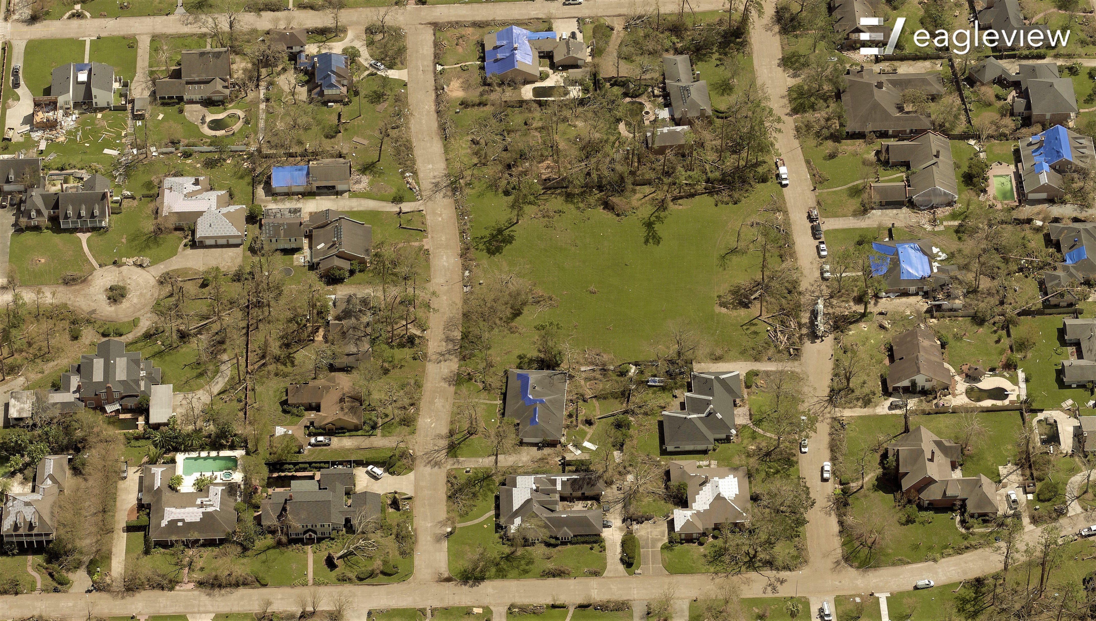
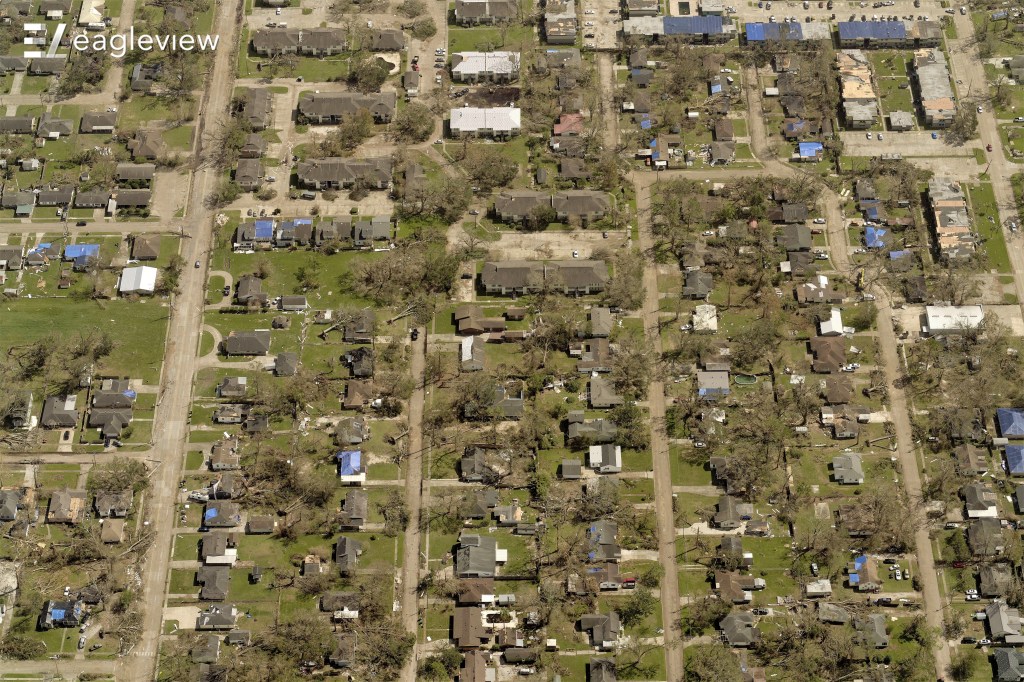
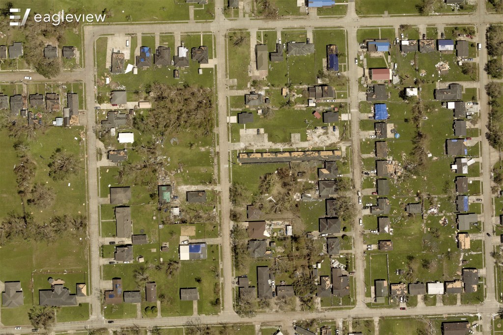 The first look at Calcasieu Parish, LA, begins to show the extent of the storm's damage
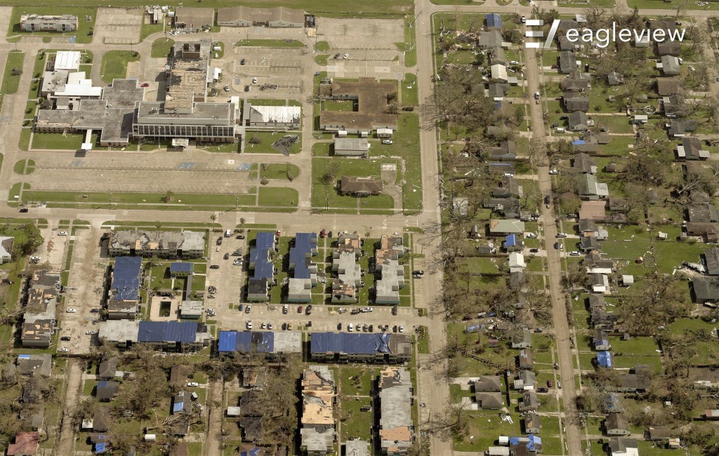 Blue tarps indicate damaged roofs
Customers can find EarlyAccess™ images on CONNECTExplorer, EagleView’s interactive viewing platform. While images continue to be processed in-house, seeing the initial impact of the damage from the sky early in the process is an invaluable resource for local governments, contractors, and insurance carriers.
“Doing our part to help affected communities in their time of need is at the core of EagleView’s mission during storm season,” said EagleView CEO Chris Jurasek.
For more information regarding EagleView’s storm response and image capture or for permission to use EagleView images, please contact Annette Hamilton at mediarelations@eagleview.com or Susan Millerick at susan.millerick@eagleview.com.
About EagleView
EagleView is a leader in aerial imagery, machine learning-derived data analytics and software, helping customers in different industries use property insights for smarter planning, building and living. With more than 200 patents, EagleView pioneered the field of aerial property measurements and has the largest multi-modal image database in history, covering 98 percent of the U.S. population. Flying over 9.5 million linear miles every year, EagleView’s coverage is the most extensive and up to date, enabling local government and business customers to use the most accurate data to make timely and informed decisions. For more information, call (866) 659-8439, visit www.eagleview.com and follow @EagleViewTech.
###
Media Contacts:
Annette Hamilton
mediarelations@eagleview.com
Susan Millerick
susan.millerick@eagleview.com