TL;DR: Ground crews take months to inspect power lines. Aerial methods get it done in days. This guide covers drones, helicopters, fixed-wing aircraft, and satellites, including what each finds, how fast they work, and what they cost per mile.
Aerial power line inspection uses drones, helicopters, planes and satellites to monitor infrastructure faster than ground crews can walk it.
Ground patrols take months. You're paying workers to cover routes mile by mile through difficult terrain, documenting problems as they find them. Aerial inspection gets the same data in days by photographing infrastructure from above.
Utilities pick between technologies based on what they need to find and how fast they need coverage.
Comparing Aerial Power Line Inspection Methods
Four approaches. The tradeoff is always detail versus speed. You can get close-up drone imaging of every asset, or you can cover your entire territory in a week. Rarely both.
| Method | Resolution | Coverage Speed | Cost per Mile | Defect Detection Capabilities |
| Drone inspection | High-resolution imagery and video | Several miles/day (slower) | Low equipment cost, slower coverage | Excellent for detailed equipment inspection; detects hot connections, cracks, and rust |
| Helicopter and LiDAR | High degree of accuracy | Hundreds of miles per day | Higher hourly cost, faster total coverage | Excellent for vegetation clearance, conductor sag; limited equipment detail and difficult data to ingest |
| Aerial imagery | 70x higher than satellite; vegetation proximity, pole height and lean, and equipment details from ortho and oblique imagery | Entire service territories captured in days | Most cost-effective for large territories | Detects vegetation encroachment, manage critical assets, and structural issues |
| Satellite imagery | Lower resolution than aerial imagery | Continuous monitoring across regions | Low cost per mile | Broad vegetation trends; limited detail |
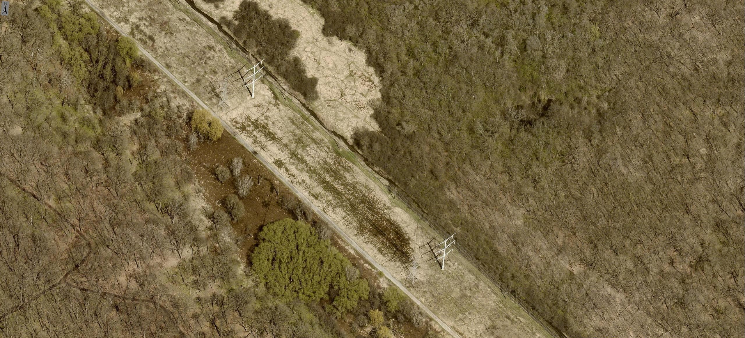
Drone inspection for distribution lines
Drones get angles your ground crews can't reach without bucket trucks.
Resolution and coverage speed
You get video and imagery that shows crack patterns, rust, and other fine details. Several miles per day, which is slow compared to helicopters, but when you need close equipment inspection, the detail justifies the time.
Cost per mile
Lower equipment costs but slower coverage than helicopters for large territories.
Defect detection capabilities
Excellent for close-up equipment inspection. Weather limits operations as wind grounds flights and rain damages equipment.
Helicopter inspection with LiDAR for transmission corridors
Helicopters cover transmission corridors fast. The LiDAR generates 3D point clouds, and those point clouds give you exact clearances between vegetation and conductors.
Resolution
LiDAR measures clearances with sub-centimeter accuracy for clearance measurements. Limited color information compared to cameras.
Coverage speed
Helicopters survey hundreds of miles per day across transmission corridors.
Cost per mile
Higher hourly rates but faster coverage reduce the total project cost for large territories.
Defect detection capabilities
Excellent for vegetation clearance measurement and conductor sag calculations. Limited detail for equipment defects.
Aerial imagery for asset and vegetation assessment
Fixed-wing aircraft can photograph your entire territory in days.
The resolution is high enough that vegetation managers can identify individual tree species and measure branch diameters across thousands of circuit miles. You get orthogonal and oblique images showing pole conditions, crossarm damage, and equipment mounting, all without sending anyone up a pole.
The imagery feeds into 3D point cloud models that calculate precise clearances between vegetation and conductors.
Resolution
70x better than satellite imagery. Identifies individual tree species and equipment details.
Coverage speed
Entire service territories captured in days, covering thousands of miles.
Cost per mile
Most cost-effective for territory-wide surveys.
Defect detection capabilities
Captures vegetation encroachment, equipment defects, structural issues, and infrastructure conditions. Eliminates geographic constraints regardless of terrain difficulty.
Satellite imagery for frequent monitoring
Utilities covering multiple states use satellites to track vegetation growth patterns and flag areas needing attention. The imagery updates regularly without flight scheduling.
Resolution
Lower resolution than aerial imagery, but frequent update cycles.
Coverage speed
Continuous monitoring across entire regions without flight scheduling.
Cost per mile
Low cost for wide areas, but insufficient detail for specific defects.
Defect detection capabilities
Works for broad vegetation trends. Cloud cover blocks views but lacks the detail needed for assessing specific equipment defects.
Defects and Hazards Detected by Aerial Power Line Inspection
Vegetation threatening lines
Trees grow toward power lines. Aerial inspection catches the encroachment before branches hit lines and conductors.
Eagleview’s TreeRisk extracts 3D point cloud data from aerial imagery to measure clearances with precision comparable to ground measurements. It assigns risk scores to individual spans based on clearance distance, tree height, and growth characteristics.
Equipment defects
Cracked insulators appear in close-up aerial shots. So do corroded fittings, loose bolts, and damaged crossarms.
Structural issues
Leaning poles appear across entire service areas in a single survey. After storms, utilities fly affected areas and map all damaged structures in hours - no need to wait days for ground crews to patrol every mile.
Building an Aerial Inspection Program for Your Utility
Regulatory requirements
Federal and state regulations require utilities to inspect transmission and distribution infrastructure regularly.
Some jurisdictions specify inspection intervals, while others focus on risk mitigation.
Data processing workflows
Processing thousands of images requires automated systems to turn raw data into actionable info.
AI analytics flags these problem areas automatically. Vegetation managers verify these flags instead of reviewing millions of images manually.
Asset management integration
Equipment age, maintenance history, and failure rates feed into existing utility databases. Inspection findings trigger work orders and update asset records.
Teams see vegetation risk on utility maps in relation to circuits, substations, and customer density through GIS integration. Spans serving hospitals or emergency services get flagged for enhanced monitoring.
Inspection frequency
Most utilities run these annually. If you've got high-risk areas or fast-growing vegetation, twice a year makes more sense.
Run late-season surveys to capture maximum growth. Early-season surveys give you your baseline.
How Eagleview Supports Aerial Power Line Inspection
Ground crews hit hazards and access problems. Aerial inspection gets the data without putting anyone in difficult terrain.
Eagleview's aerial imagery captures at 70x satellite resolution. That means your team can identify individual tree species and spot equipment defects like cracked insulators across thousands of circuit miles.
The AI flags problems automatically. MapBooks show exact problem locations with coordinates and imagery. Your crews see what needs attention before they drive out.
The automation lets you scale inspection operations while reducing costs and keeping people out of hazardous conditions.
Integrate Aerial Power Line Inspection with Eagleview
Aerial power line inspection doesn't eliminate ground work. Repairs need fieldwork regardless. But utilities using aerial inspection reduce ground patrol miles significantly. Crews drive to specific problem locations instead of surveying entire routes and arrive knowing what they'll find.
Want to see how Eagleview’s insight can give you more data?
Contact Eagleview to see how aerial imagery works for your territory.