 Ultra-high-resolution aerial imagery launches at FutureView in Austin, Texas
Bothell, Wash. (August 28, 2018) – Eagle View Technologies
Ultra-high-resolution aerial imagery launches at FutureView in Austin, Texas
Bothell, Wash. (August 28, 2018) – Eagle View Technologies (“EagleView®”), the leading provider of aerial imagery and property data for the government, construction, energy and insurance industries, today announced it will begin capturing
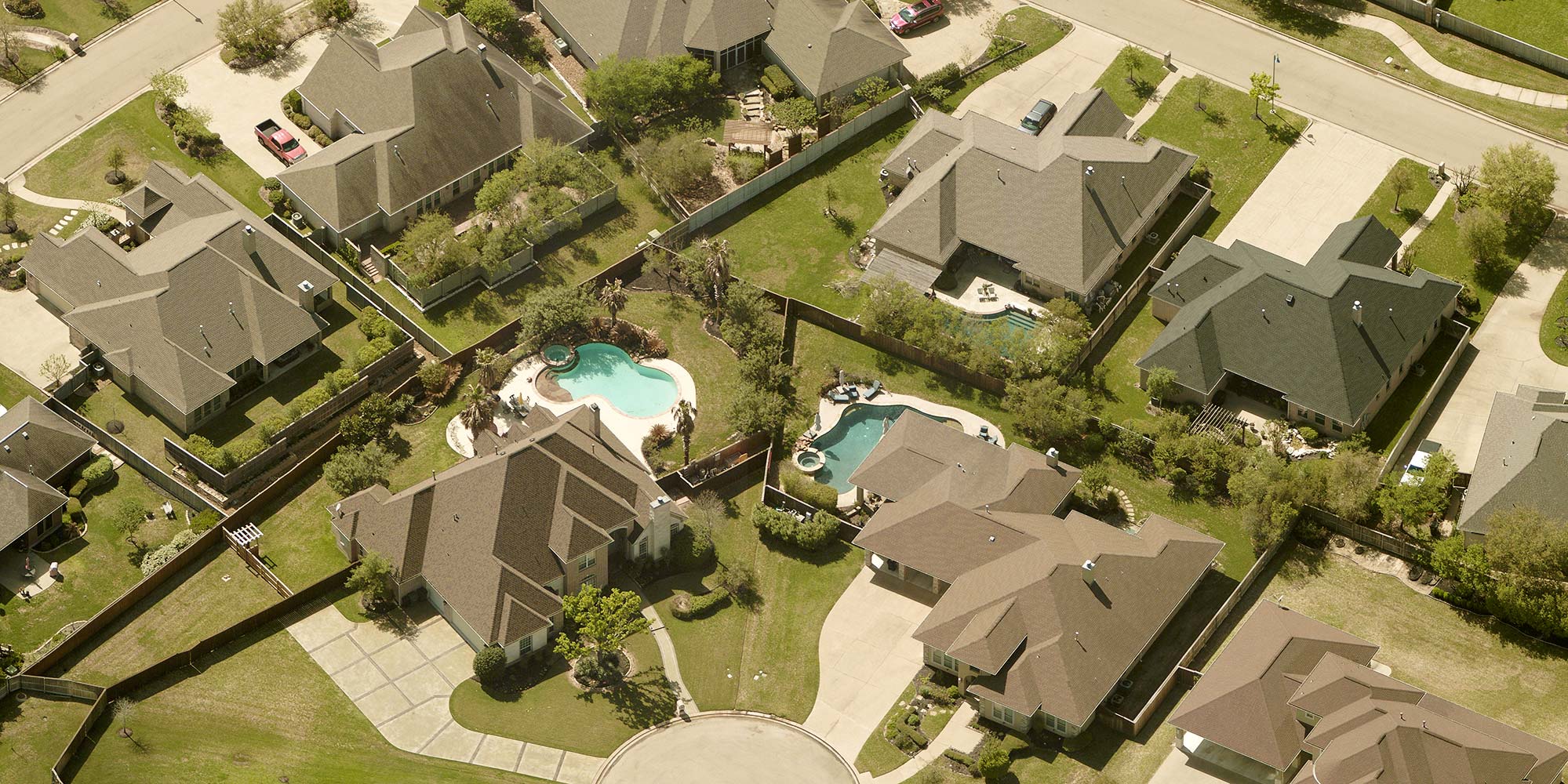
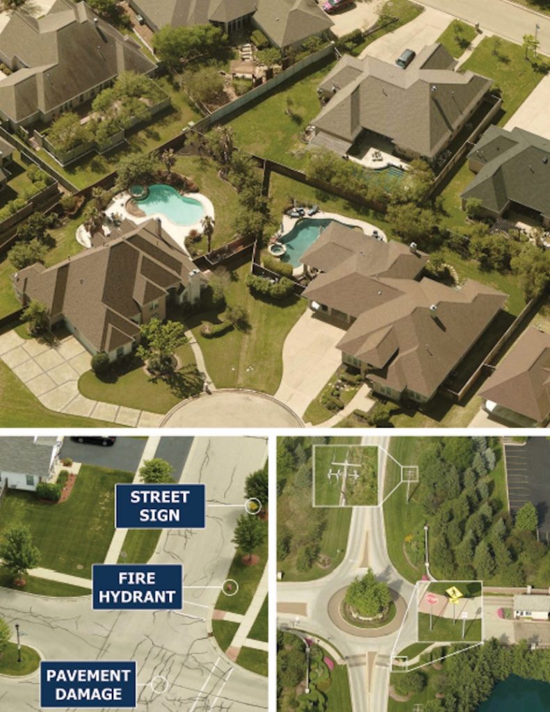
ultra-high-resolution Reveal™ imagery this fall. This latest innovation includes oblique and orthogonal images that display an unprecedented level of detail, enabling the identification of property features not visible from other imagery sources. In addition, Reveal delivers the clarity necessary to assess grade and condition of residential and commercial properties, infrastructure and ground elements right from the desk.
EagleView’s next-generation aerial camera system captures ultra-high-resolution imagery, enabling efficient acquisition with faster delivery times. With the addition of Reveal imagery, EagleView’s library of high-resolution aerial images will provide more detail and answers than ever before.
EagleView established the current
aerial imagery standard for resolution years ago with images that are 2-inch to 3-inch Ground Sample Distance (GSD), or 2-inch to 3-inch per pixel on the ground. Reveal resets that bar with imagery as fine as 0.75-inch GSD per pixel, adding as much as 4 to 16 times more image data.
“We’re starting a resolution revolution. This groundbreaking imagery is going to dramatically change the industries we serve,” said EagleView CEO Rishi Daga. “Reveal imagery offers the most detail, clarity and accuracy you will see in aerial imagery today.”
With ultra-high-resolution imagery, local and county government departments, including property assessment, GIS, public safety and public works, can improve their daily workflows and confidently serve their communities when inspecting remotely.
“EagleView builds on its 18-year history of industry-leading aerial image capture innovation with the launch of Reveal,” stated EagleView CTO Ajai Sehgal. “This ultra-high-resolution imagery delivers the answers needed for government agencies to perform at their best each and every day.”
EagleView will be showcasing Reveal imagery at the 2018
FutureView User Conference at the Austin JW Marriott, August 27 to 30, 2018.
For more information regarding Reveal imagery and data analytics from EagleView, please contact Melissa Mazurek at
melissa.mazurek@eagleview.com or (585) 444-2504.
About EagleView
EagleView is the leading provider of
high-resolution aerial imagery, property data analytics and structural measurements for government agencies, insurance carriers, roofing contractors and energy utilities. Using patented image capture techniques, 3D aerial measurement software and machine learning processes, EagleView helps customers answer questions related to millions of properties throughout the world. With a 60-petabyte library of oblique and orthogonal Pictometry® aerial imagery dating back to 2001 and the capacity to process tens of thousands of roof measurement reports per day, EagleView enables organizations to reduce field visits and adopt faster, safer and more cost-effective workflows. For more information, contact (866) 659-8439 or visit
www.eagleview.com.