EagleView Captures High-Resolution Aerial Imagery at Unmatched 1-Inch GSD to Support Immediate Hurricane Helene Recovery Efforts

Hurricane Helene made landfall late Thursday evening as a powerful Category 4 storm in Florida’s Big Bend region, before continuing to move north, bringing historic storm surge, heavy rain, and strong winds across the Southeast. According to poweroutage.us, more than 4 million homes and businesses were without power across Florida, Georgia, South Carolina, Tennessee, and Virginia as of Friday morning.
As the impacts of the storm continue to be felt, our thoughts are with the affected communities and many individuals working tirelessly to support recovery efforts. Flood warnings continue to be in effect for regions in the path of the storm, as emergency personnel continue to carry out rescue efforts.
To support response, EagleView is again capturing 1-inch (2.54 centimeter) GSD imagery of populated, affected areas in the hurricane's path as part of its Disaster Response Program (DRP). Imagery from captured areas will be an available resource for emergency management personnel, government agencies, energy providers, insurance companies, property managers, and others in critical sectors. EagleView’s 1-inch GSD imagery delivers 9 times more pixel data than traditional 3-inch GSD imagery and up to 70 times more pixel data than commercially available satellite imagery. This groundbreaking technology can help those leading the recovery efforts by providing unparalleled accuracy for critical decision-making in disaster recovery and beyond.
EagleView previously captured 1-inch GSD imagery for Hurricane Francine recovery efforts, with a sample made available here. This time, EagleView is capturing high-resolution 1-inch GSD imagery in the Big Bend area of Florida to help enhance the speed and effectiveness of disaster response operations.
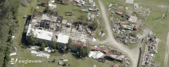
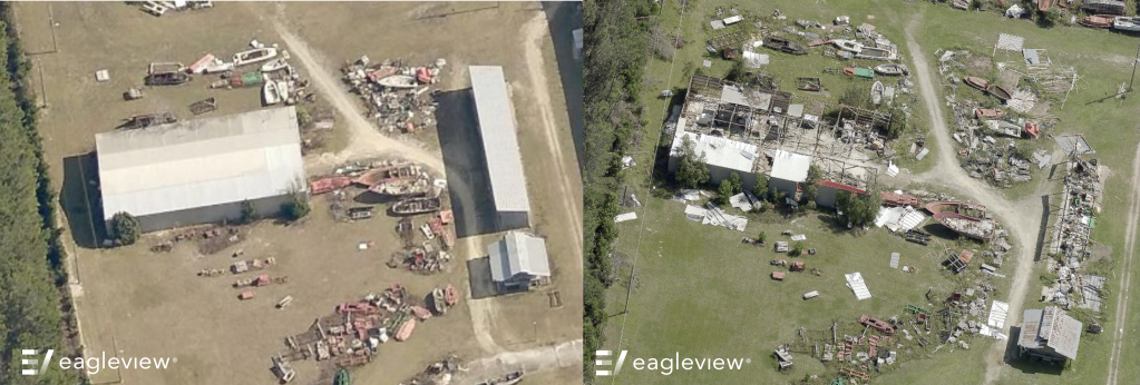
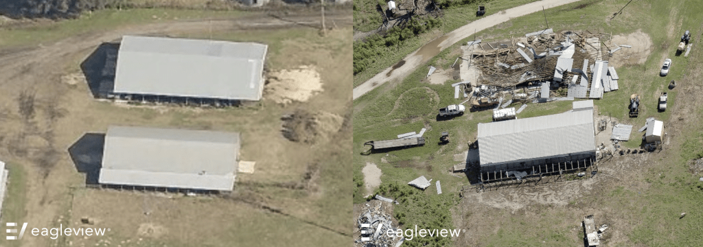
Sample imagery captured by EagleView reveals the extent of the damage in affected areas:


The 1-inch (2.54 centimeter) GSD imagery will be captured as part of EagleView’s Disaster Response Program (DRP), which has supported communities for more than 20 years. Traditionally, high-resolution imagery and data are captured for EagleView customers immediately following severe weather events. For existing customers with historical imagery, EagleView’s data applications and change detection solutions can visualize building outlines and show where change has occurred as the result of damages, further streamlining post-disaster assessment and reducing response time.
However, due to Hurricane Helene’s impact, EagleView is extending this offer beyond its usual customer base to assist more organizations in need. A selection of this imagery is also available for media use by contacting mediarelations@eagleview.com.
We remain in close communication with our customers in affected counties and our thoughts are with those impacted by this historic storm. If your organization needs access to Hurricane Helene imagery to support recovery efforts, please contact us.
