Drone data collection has rapidly emerged as a powerful solution for industries seeking faster, safer, and more accurate means of gathering information. Data collection no longer requires large teams, multiple site visits, or exposure to dangerous environments. Today, unmanned aerial vehicles (UAVs)—commonly known as drones—partnered with advanced software and sensors allow professionals to collect vast amounts of aerial data in a fraction of the time it once took.
In this guide, we explore how Eagleview’s drone technology optimizes data collection methods, the advantages of adopting drone-based workflows, and the ways in which different sectors, including construction, insurance, and government agencies, can harness the power of drone data collection.
Introduction to Drone Data Collection
Drone data collection refers to the use of UAVs equipped with cameras, sensors, and other tools to capture aerial images, videos, and measurements for analysis. These aerial platforms can hover, fly pre-programmed routes, and capture information from multiple angles, providing a comprehensive overview of a site or asset.
These drones integrate with geographic information systems (GIS), 3D mapping software, and specialized analytics platforms to process aerial data in real-time. Operators can plan flight paths in advance to ensure thorough coverage, enabling consistent and repeatable data collection. Once drones land, geospatial data is retrieved and processed into actionable insights, ranging from 3D terrain models to volumetric calculations and detailed imagery reports.
Initially, drones were associated with military or hobbyist pursuits. However, technological advancements—such as longer battery life, lightweight materials, and improved sensor resolution—have rapidly expanded their commercial applications. Today, industries use drone technology to streamline workflows and reduce reliance on costly or hazardous manual inspections.
Key Benefits of Drone Data Collection
The advantages of adopting drone data collection are substantial and often interrelated. By leveraging Eagleview’s advanced technology, organizations can enhance the accuracy of their insights, improve on-site safety, and save money through increased efficiency.
Accuracy
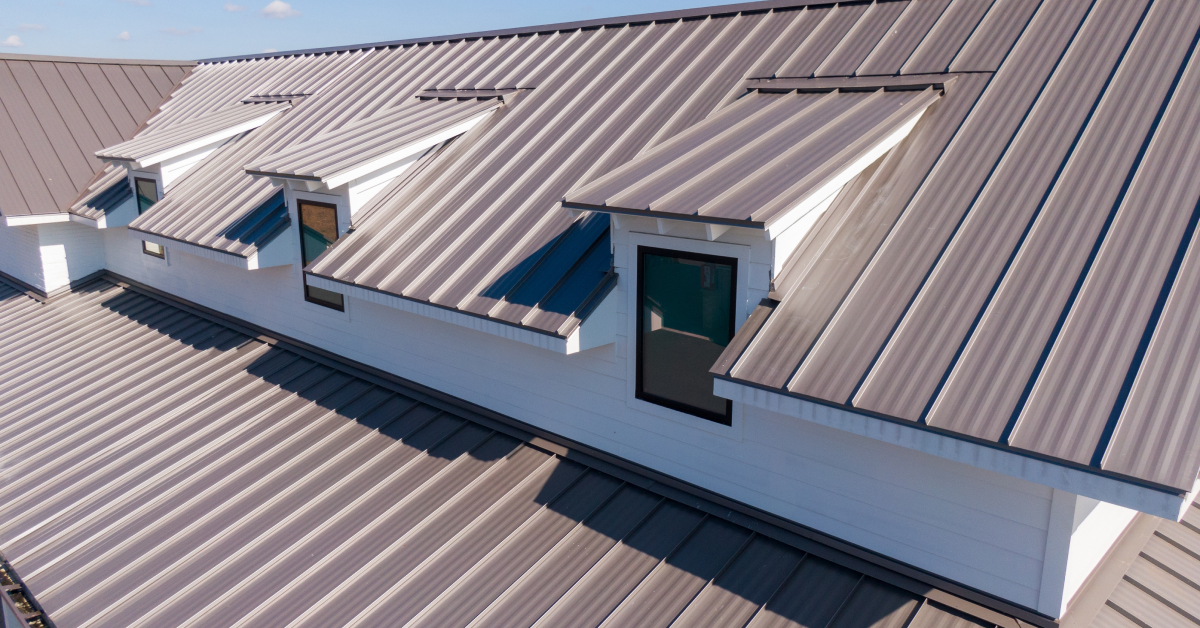
Drones capture high-resolution aerial images and abundant geospatial data, ensuring precise measurements and assessments. This accuracy is important in fields where small errors can result in significant cost overruns or complicated legal disputes. In construction, for instance, a few inches can mean the difference between seamlessly connecting pieces of a project and incurring costly material reorders.
Safety
One of the most significant benefits of drone technology is the ability to reduce risk for human workers. Traditional data collection methods—such as climbing rooftops, scaffolding, or navigating rugged terrains—carry inherent dangers. Deploying a drone, operators can capture the same, if not higher-quality, data without placing themselves in harm’s way. For insurance adjusters, that means evaluating storm-damaged rooftops safely from the ground. For construction managers, it means reducing the need for repeated site visits in dangerous areas.
Cost savings
By reducing manual labor, preventing rework, and accelerating job timelines, drone data collection cuts costs across an organization’s workflow. The immediate operational expenses, such as helicopter rentals or large survey teams, fall dramatically. Over the long run, teams discover that quickly identifying and addressing potential problems saves money on reconstruction, repairs, and delays. Businesses also gain revenue opportunities by taking on more projects or offering expedited services due to shorter turnaround times.
Implementation and Integration
Adopting drone-based solutions demands more than simply purchasing equipment. It requires thoughtful integration into existing workflows, proper training, and a keen understanding of the regulatory landscape. Below are some best practices.
- Workflow assessment: Before implementing drone data collection, evaluate the current workflow to pinpoint areas where aerial data collection would have the most impact. This ensures your drone deployment strategy targets high-value tasks without cluttering established operations.
- Training and certifications: Operators must obtain the necessary pilot certifications to comply with local aviation laws.
- Regulatory compliance: Different regions have varying rules about drone registration, flight height restrictions, and no-fly zones. Understand and adhere to these regulations to avoid fines, legal complications, or reputational damage.
- Choosing the right drone technology: The type of drone, sensor payload (e.g., standard camera vs. LiDAR technology), flight time, and data processing software should all align with each project’s requirements.
Benefits of Eagleview Drone Technology
Eagleview’s cutting-edge drone solutions offer a comprehensive approach to aerial data collection. While traditional data capture methods often rely on outdated surveying techniques or manual inspections, Eagleview combines powerful hardware and sophisticated software to transform the way businesses gather intelligence about their assets and environments. Our commitment to innovation allows us to remain at the forefront of drone technology and deliver results clients can trust, such as:
High-resolution imaging
Eagleview drones come equipped with advanced cameras that capture crisp images from a range of altitudes, which allows for improved quality control and more accurate measurements.
Real-time data processing
Through integrated software, our drones process data mid-flight or immediately after landing, enabling rapid adjustments based on the findings, and significantly accelerates workflow efficiency.
Integration with GIS and mapping software
Eagleview’s technology integrates smoothly with various GIS platforms, making it easy to overlay drone data onto existing maps and generate sophisticated 3D models or topographic analyses.
Industry Applications
Drone data collection is not limited to one sector; rather, it’s a flexible tool applicable wherever accurate, timely, and cost-effective information is needed. Below, we highlight three key industries—construction, insurance, and government—that have embraced Eagleview’s drone solutions.
Construction
In construction, drone data collection is revolutionizing site surveys, project planning, and timeline management. High-resolution aerial images provide an overview of the entire site, helping managers plan material usage, allocate labor efficiently, and identify potential issues early.
Integrating frequently updated aerial imagery into project management software allows teams to track progress in near real-time. Additionally, 3D models generated from drone data offer a more detailed perspective on terrains, elevations, and structures, assisting with cost projections and inventory control. When combined with geospatial data collection, drones prove essential for verifying whether the as-built conditions match the as-planned diagrams, saving both time and money in rework.
Insurance
For insurers, Eagleview’s drone platform delivers a safer and faster way to assess properties. Rather than assigning field adjusters to manually climb rooftops and navigate potentially unsafe areas, operators can launch a drone to capture high-resolution images and precise measurements. Adjusters can analyze the collected data to validate claims, detect potential fraud, and finalize estimates with greater accuracy. Some insurers have also found additional uses, such as monitoring flood plains and coastal erosion to set premiums or preempt coverage risks. The end result is an improved customer experience, reduced liability, and significant savings on operational costs.
Government
Government agencies employ drones for urban planning, infrastructure inspections, and emergency responses. Drone data can pinpoint weaknesses in roads, bridges, and utilities before they escalate into serious failures, supporting proactive maintenance. In disaster scenarios, such as wildfires, floods, or hurricanes, aerial data analysis provides real-time situational awareness that shapes effective rescue and relief operations. Eagleview’s drone solutions can also aid in geospatial data collection for environmental monitoring, helping authorities track deforestation, land-use changes, or local wildlife habitats.
Improve Your Operations with Eagleview
Data drives decisions, and adopting drone data collection has quickly become a competitive advantage. Whether you’re in construction, insurance, or a government agency, leveraging accurate, high-resolution aerial insights can streamline operations, reduce risk to personnel, and bolster cost savings.
Ready to discover how Eagleview can transform your workflow through drone data collection? Contact us today to schedule a personalized demo.