
High-quality oblique aerial imagery is invaluable for helping government agencies boost efficiency and deliver comprehensive services for the communities that they serve.
Read on to learn how to get the most value possible from your imagery portfolio, as well as additional ways that high-resolution oblique imagery can be used across multiple departments.
Assessment Boards/County Tax Assessors
The less often assessors must manually inspect properties, the more productive they can be. A key benefit of aerial imagery is the ability to conduct remote property inspections and valuations, making it far easier for assessors to maintain accurate tax rolls, as well as stay on top of property improvements and new construction.
In addition to offering a fast, accurate way to inspect properties, some aerial imagery providers offer integrations with leading Computer Aided Mass Appraisal (CAMA) systems, helping streamline workflows and standardize the assessment process.
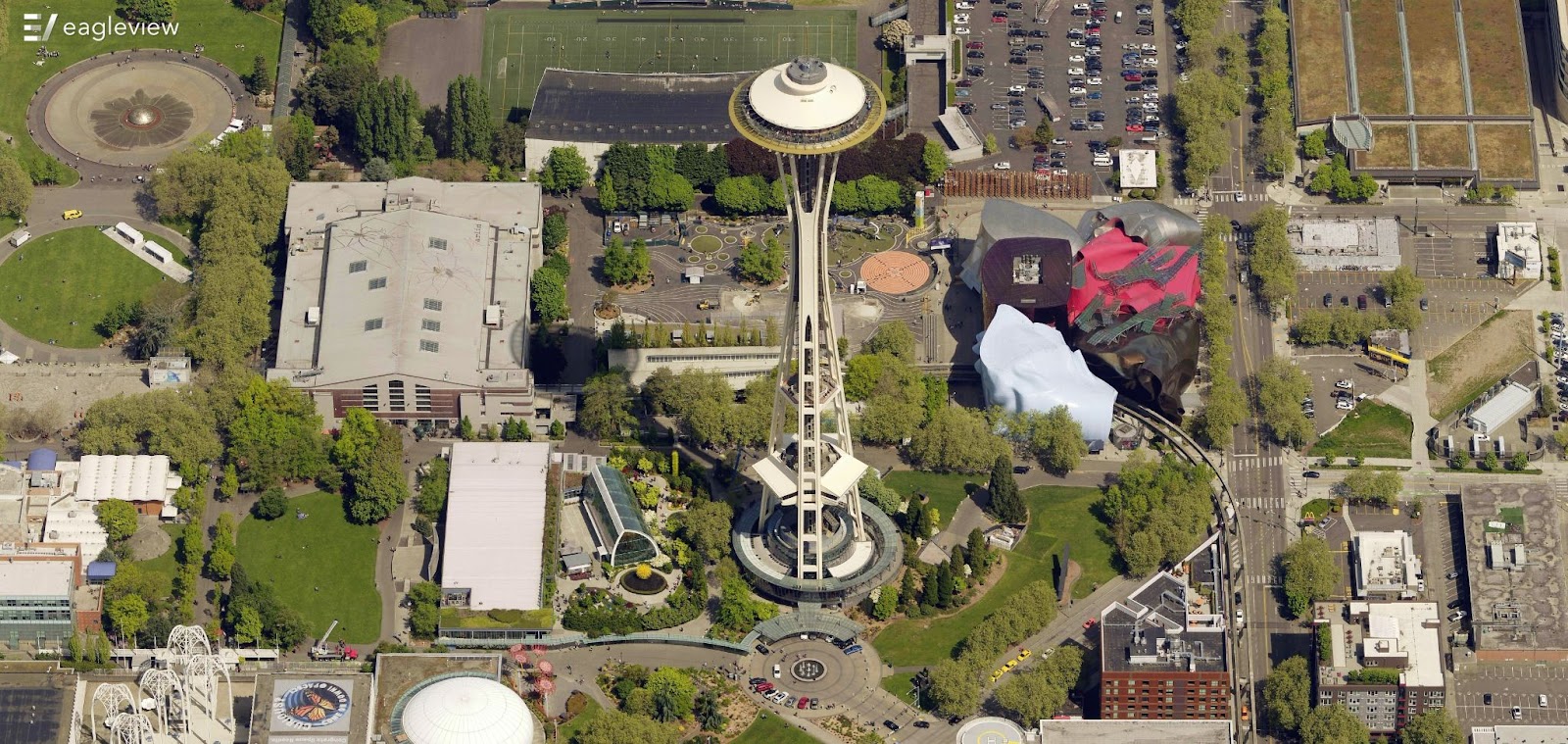
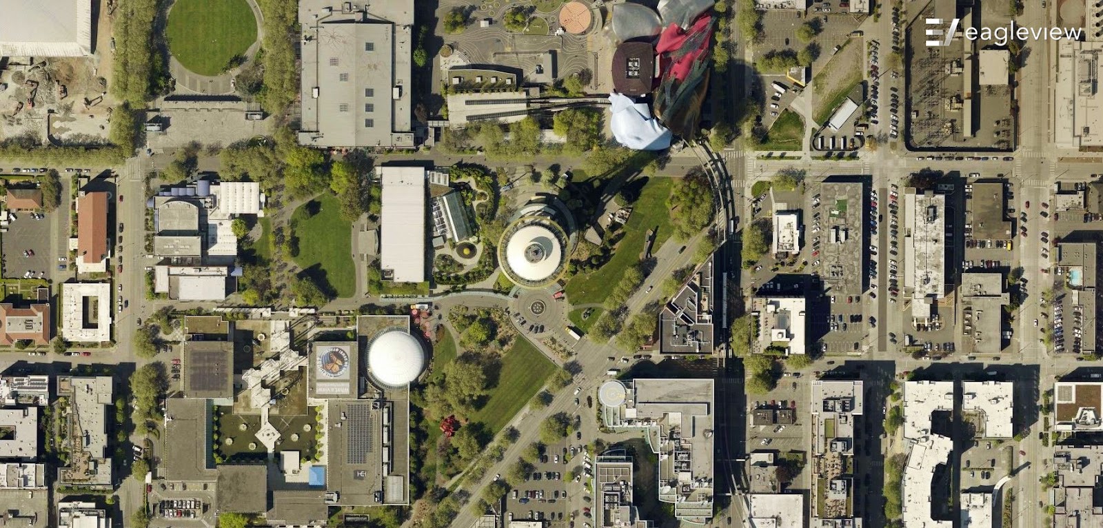
To get the most benefit for assessments from your aerial imagery portfolio, consider using change detection solutions to compare your latest image capture to historical imagery and data. Accurate change detection helps assessment teams prioritize their remote inspections and desktop reviews. Plus, by incorporating oblique (side-angled) in addition to traditional orthogonal (top-down) imagery, you can view structural additions or changes from every angle for more accurate valuations.
Oblique (Side-Angled)
Orthogonal (Top-Down)
Disaster Preparedness/Emergency Planning
Aerial imagery supports a variety of emergency management tasks, including:
- Pinpointing areas most vulnerable to flooding, wildfires, and other catastrophic weather events.
- Planning emergency evacuation routes and response staging areas.
- Capturing timely post-disaster imagery for rapid damage assessments.
- Helping disaster response teams react quickly and confidently.
Advanced tools and image capture techniques can also help teams mitigate and monitor known risk factors. For instance, 3D mesh visualization tools enable floodplain analysis and water runoff path forecasting. And near-infrared image capture can help teams pinpoint and monitor the condition of vegetation to identify encroachment and wildfire risk.
High-resolution aerial imagery provides GIS teams with the visual context and intelligence needed to maintain accurate and actionable geospatial data, helping the agencies they serve make better deployment and policy decisions.
Oblique aerial imagery in particular provides critical context by allowing users to see the same imagery from all angles, making it more authoritative and giving users more confidence. And accurate geo-referencing of aerial imagery helps with timely property addressing initiatives for new developments.
Public Works
Oblique aerial imagery provides public works teams with remote access to precise structural details, helping them identify assets and analyze environmental conditions. Teams can locate, inspect, and inventory assets (e.g., fire hydrants, manholes, signage, traffic signals), measure roads and bridges, and pre-plan infrastructure projects—all without on-site visits.
Aerial imagery can also be accessed using existing software platforms, enabling agencies to easily catalog and monitor their assets, as well as better plan projects and maintain infrastructure.
Public Safety/911
Access to accurate and timely location information is crucial during an emergency. Oblique aerial imagery allows dispatchers, public safety teams, and law enforcement to visualize the scene, saving critical time and providing the intelligence they need to respond safely and effectively.
- By integrating oblique aerial imagery with computer-aided dispatch software, dispatchers can quickly pinpoint a 911-caller’s location, share essential site details with emergency response teams, and calculate the fastest possible route.
- Law enforcement can conduct remote site reviews when preparing for SWAT raids or service of a warrant, as well as identify surveillance and staging sites.
- Fire departments can use oblique imagery for training and for fire response pre-planning—especially to see potential hazards around buildings—as well as current and historic views for fire investigations and reports.
“We are honored to partner with local governments across so many departments and use cases. We know that our customers rely on the quality, accuracy and accessibility of our imagery in their day-to-day work, and we’re proud to be a partner in helping them meet the needs of their communities.”
Robert Locke, President of Government Solutions at EagleView
Interested in learning more about aerial imagery technologies in real-world government situations? Check out our favorite use cases and customer case studies.