
December 29, 2016
Mitigating Outages and Planning Expansions with Smart Grids
These days, everything is “smart.” Smart phones, smart watches, smart cars, smart homes, and smart appliances connected to the Internet of Things all shape our […]
These days, everything is “smart.” Smart phones, smart watches, smart cars, smart homes, and smart appliances connected to the Internet of Things all shape our […]
On November 16, we celebrated GIS Day from Esri® — a day that demonstrates the real-world applications of geographic information systems, or GIS, through community […]

Updated December 2018 ’Tis the season for celebrations, decorative displays, travel, gift-giving… and maps? Geographic information systems, known as GIS, may sound like all work […]

Each month, we share an image from our annual Pictometry® calendar right here on our blog. For 2016, we selected 12 of our favorite images […]

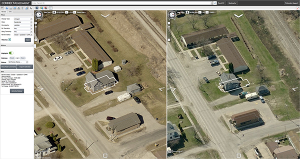
Updated December 2018 A winter storm blows through your region and leaves neighborhoods buried under layers of snow. Soon enough, the calls come in from […]
Early in December, footage surfaced on the internet of a traffic pileup on a Montreal street. The video shows buses, passenger vehicles, a snow plow, […]

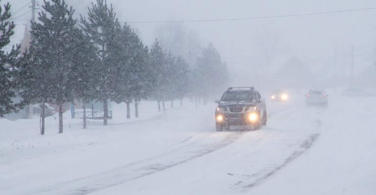
Updated January 2019 While winter weather may not sound like a big deal to some, it can lead to costly – and even deadly – […]
With the New Year almost here, those of us with Type-A personalities are already busting out new day planners and creating our to-do lists for […]

Updated December 2018 Americans, like House Stark, know one thing for certain: winter is coming. For consumers, cold weather concerns tend to be more practical. […]
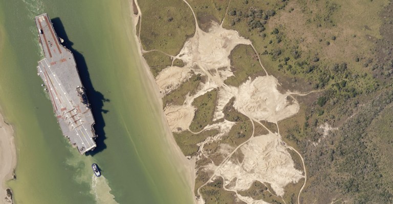
The 2016 calendar showcases twelve of our team’s favorite Pictometry images out of more than 28 million captured in the 2014-2015 image season. The November […]